
IMAGES TAKEN NEAR TO
Shinfield Road, READING, RG2 7BW
Introduction
This page details the photographs taken nearby to Shinfield Road, RG2 7BW by members of the Geograph project.
The Geograph project started in 2005 with the aim of publishing, organising and preserving representative images for every square kilometre of Great Britain, Ireland and the Isle of Man.

There are currently over 7.5m images from over14,400 individuals and you can help contribute to the project by visiting https://www.geograph.org.uk
Image Map
Images are licensed for reuse under creativecommons.org/licenses/by-sa/2.0
Notes
- Clicking on the map will re-center to the selected point.
- The higher the marker number, the further away the image location is from the centre of the postcode.
Image Listing (49 Images Found)
Images are licensed for reuse under creativecommons.org/licenses/by-sa/2.0
Image
Details
Distance
1

A327 Shinfield Road
Heading towards central Reading. The illuminated sign ahead conveys a wonderfully counter-productive message once your mind and vision have been occupied puzzling out what it says: "Think! Look out for other road users". If there is no useful message, just switch off the sign!
Image: © Robin Webster
Taken: 22 Aug 2020
0.02 miles
2

Shinfield entrance to Reading University
Image: © Andrew King
Taken: 16 Oct 2010
0.04 miles

4

Whiteknights Park Lodge
Whiteknights Park, campus of Reading University. This is an entrance lodge on The Chancellor's Way.
Whiteknights was home to a former Duke of Marlborough who went bankrupt and sold the estate. The house was demolished in 1840, allegedly by his angry creditors.
http://en.wikipedia.org/wiki/Whiteknights_Park
Image: © Des Blenkinsopp
Taken: 5 Jul 2012
0.08 miles

6

The exit from Reading University on Shinfield Road
Image: © David Howard
Taken: 6 Mar 2016
0.08 miles
7

Benchmark on boundary wall of #31 Shinfield Road
Ordnance Survey cut mark benchmark described on the Bench Mark Database at http://www.bench-marks.org.uk/bm58539
Image: © Roger Templeman
Taken: 3 Jul 2014
0.08 miles
8
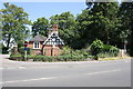
#31 Shinfield Road at The Chancellor's Way junction
There is an OS benchmark Image on the right hand end of the low brick wall in front of the house at the junction with a wooden fence
Image: © Roger Templeman
Taken: 3 Jul 2014
0.08 miles

10

Benchmark on #46 Shinfield Road
Ordnance Survey cut mark benchmark described on the Bench Mark Database at http://www.bench-marks.org.uk/bm59548
Image: © Roger Templeman
Taken: 3 Jul 2014
0.10 miles