
IMAGES TAKEN NEAR TO
Stansfield Close, READING, RG2 7BQ
Introduction
This page details the photographs taken nearby to Stansfield Close, RG2 7BQ by members of the Geograph project.
The Geograph project started in 2005 with the aim of publishing, organising and preserving representative images for every square kilometre of Great Britain, Ireland and the Isle of Man.

There are currently over 7.5m images from over14,400 individuals and you can help contribute to the project by visiting https://www.geograph.org.uk
Image Map
Images are licensed for reuse under creativecommons.org/licenses/by-sa/2.0
Notes
- Clicking on the map will re-center to the selected point.
- The higher the marker number, the further away the image location is from the centre of the postcode.
Image Listing (25 Images Found)
Images are licensed for reuse under creativecommons.org/licenses/by-sa/2.0
Image
Details
Distance
1
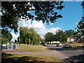
Windermere Willow
A nice willow tree beside Windermere Road.
Image: © Des Blenkinsopp
Taken: 5 Jul 2012
0.08 miles
2

Reading South Telephone Exchange
http://www.samknows.com/broadband/exchange/THS
Image: © Des Blenkinsopp
Taken: 5 Jul 2012
0.09 miles
3

#100 Shinfield Road
Ordnance Survey documents indicate that in 1973 a benchmark levelled at 81.228m above Newlyn Datum was verified on the (then) set back front face of the house at its left hand corner. Since then that section of the house has been extended forward with loss of the mark
Image: © Roger Templeman
Taken: 25 Sep 2017
0.12 miles
4

Reading Bedding
I am guessing this was a former co-op store. Not easily visible at this range but the greenish top panel to the left of the corner is a faded mosaic reading "Society Ltd". The others maybe would have said Reading Co-operative or something?
Image: © Des Blenkinsopp
Taken: 5 Jul 2012
0.12 miles

6

#24 Cressingham Road at Barnsdale Road junction
There is an OS benchmark Image on the front of the house at its left hand corner, left of the black downpipe
Image: © Roger Templeman
Taken: 12 May 2014
0.13 miles

8

#116 Shinfield Road, 'Mark Ash'
There is an OS benchmark Image on the attached garage of the house, behind the car
Image: © Roger Templeman
Taken: 12 May 2014
0.13 miles
9

Benchmark on garage of #116 Shinfield Road
Ordnance Survey cut mark benchmark described on the Bench Mark Database at http://www.bench-marks.org.uk/bm54342
Image: © Roger Templeman
Taken: 12 May 2014
0.13 miles
10

Benchmark on #24 Cressingham Road
Ordnance Survey cut mark benchmark described on the Bench Mark Database at http://www.bench-marks.org.uk/bm57353
Image: © Roger Templeman
Taken: 12 May 2014
0.13 miles