
IMAGES TAKEN NEAR TO
Maufe Close, HOOK, RG27 9YB
Introduction
This page details the photographs taken nearby to Maufe Close, RG27 9YB by members of the Geograph project.
The Geograph project started in 2005 with the aim of publishing, organising and preserving representative images for every square kilometre of Great Britain, Ireland and the Isle of Man.

There are currently over 7.5m images from over14,400 individuals and you can help contribute to the project by visiting https://www.geograph.org.uk
Image Map
Images are licensed for reuse under creativecommons.org/licenses/by-sa/2.0
Notes
- Clicking on the map will re-center to the selected point.
- The higher the marker number, the further away the image location is from the centre of the postcode.
Image Listing (18 Images Found)
Images are licensed for reuse under creativecommons.org/licenses/by-sa/2.0
Image
Details
Distance

2

Papermill Avenue, Hook
New housing on the edge of Hook. There is a mill not far away on the River Whitewater. Presumably it used to make paper.
Image: © Des Blenkinsopp
Taken: 20 Apr 2023
0.12 miles
3

Leyland Road, Hook
Like everywhere else round here, Hook is expanding. This is part of a recent development north of the A30.
Image: © Des Blenkinsopp
Taken: 20 Apr 2023
0.13 miles
4

Searl's Crescent, Hook
Part of a recent development.
Searl's Farm is shown nearby, so chances are this street was once one of their fields.
Image: © Des Blenkinsopp
Taken: 20 Apr 2023
0.14 miles

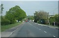
7

House on London Road, Hook
There is a small industrial complex on the right in what looks like old farm buildings
Image: © David Howard
Taken: 18 Mar 2012
0.15 miles
8
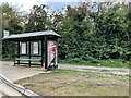
Hook House Farm bus stop
On the London Road, A30.
Image: © Fernweh
Taken: 12 Oct 2022
0.17 miles
9

Causeway over a Swampy Bit
A low lying damp area between two estates of new housing has been made into a small wetland park. Access through the middle of it has been made via a boardwalk and this causeway over the wettest part.
Image: © Des Blenkinsopp
Taken: 7 Feb 2023
0.20 miles
10

Boardwalk over Marshy Ground
A low lying damp area between two estates of new housing has been made into a small wetland park. Access through the middle of it has been made via a boardwalk.
Image: © Des Blenkinsopp
Taken: 7 Feb 2023
0.21 miles