IMAGES TAKEN NEAR TO
Ravenscroft, HOOK, RG27 9NN
Introduction
This page details the photographs taken nearby to Ravenscroft, RG27 9NN by members of the Geograph project.
The Geograph project started in 2005 with the aim of publishing, organising and preserving representative images for every square kilometre of Great Britain, Ireland and the Isle of Man.

There are currently over 7.5m images from over14,400 individuals and you can help contribute to the project by visiting https://www.geograph.org.uk
Image Map
Images are licensed for reuse under creativecommons.org/licenses/by-sa/2.0
Notes
- Clicking on the map will re-center to the selected point.
- The higher the marker number, the further away the image location is from the centre of the postcode.
Image Listing (17 Images Found)
Images are licensed for reuse under creativecommons.org/licenses/by-sa/2.0
Image
Details
Distance
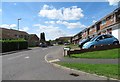
4
Hook: Wild Herons
Wild Herons is the name of the road in this housing estate with the view showing typical houses.
Image: © Nigel Cox
Taken: 9 Feb 2006
0.13 miles
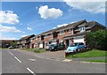
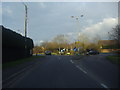
6
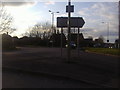
B3349 approaches roundabout crossing of A30
Image: © Stuart Logan
Taken: 3 Jul 2014
0.15 miles
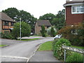
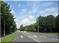
7
London Road, Hook
Approaching the Griffin Way roundabout
Image: © David Howard
Taken: 18 Mar 2012
0.18 miles
8
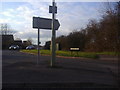
Corner of London Road and Griffin Way North
Image: © David Howard
Taken: 18 Mar 2012
0.19 miles
9
Overlooking Griffin Way North from London Road, Hook
Image: © David Howard
Taken: 18 Mar 2012
0.20 miles
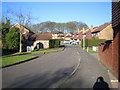
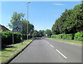
10
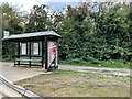
Hook House Farm bus stop
On the London Road, A30.
Image: © Fernweh
Taken: 12 Oct 2022
0.22 miles