
IMAGES TAKEN NEAR TO
Mattingley, HOOK, RG27 8JX
Introduction
This page details the photographs taken nearby to RG27 8JX by members of the Geograph project.
The Geograph project started in 2005 with the aim of publishing, organising and preserving representative images for every square kilometre of Great Britain, Ireland and the Isle of Man.

There are currently over 7.5m images from over14,400 individuals and you can help contribute to the project by visiting https://www.geograph.org.uk
Image Map
Images are licensed for reuse under creativecommons.org/licenses/by-sa/2.0
Notes
- Clicking on the map will re-center to the selected point.
- The higher the marker number, the further away the image location is from the centre of the postcode.
Image Listing (17 Images Found)
Images are licensed for reuse under creativecommons.org/licenses/by-sa/2.0
Image
Details
Distance


5

Cowfold Lane
A small stream is crossed here, the waters make their way to the Thames via the Whitewater, Blackwater and Loddon.
Image: © Robin Webster
Taken: 24 Nov 2014
0.17 miles

7

Old Milestone by the B3349, south of Mattingley, Rotherwick Parish
Carved stone post by the B3349, in parish of ROTHERWICK (HART District), near Stoker's Farm, partially buried 50 metres south of entrance to Stokers Farm on opposite side (DANGEROUS), on West side of road. Hook pillar, erected by the Basingstoke, Hartfordbridge & Blackwater (and Odiham) turnpike trust in the 19th century.
Inscription reads:-
: TO / READING / (11) : : TO / ODIHAM / (4) :
Milestone Society National ID: HA_REOD11.
Image: © K Lawrence
Taken: 22 Feb 2003
0.17 miles

9
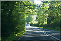
B3349 Reading Road
Towards Reading from Hook.
Image: © Robin Webster
Taken: 18 Jul 2021
0.18 miles
