
IMAGES TAKEN NEAR TO
Eastwood Place, HOOK, RG27 0FQ
Introduction
This page details the photographs taken nearby to Eastwood Place, RG27 0FQ by members of the Geograph project.
The Geograph project started in 2005 with the aim of publishing, organising and preserving representative images for every square kilometre of Great Britain, Ireland and the Isle of Man.

There are currently over 7.5m images from over14,400 individuals and you can help contribute to the project by visiting https://www.geograph.org.uk
Image Map
Images are licensed for reuse under creativecommons.org/licenses/by-sa/2.0
Notes
- Clicking on the map will re-center to the selected point.
- The higher the marker number, the further away the image location is from the centre of the postcode.
Image Listing (7 Images Found)
Images are licensed for reuse under creativecommons.org/licenses/by-sa/2.0
Image
Details
Distance
1
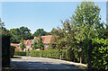
Eastwood Place
A residential cul de sac off St Neot's Road.
Image: © Des Blenkinsopp
Taken: 13 Aug 2022
0.03 miles
2

Eversley
Taken from the minor road, around mid-square, looking south past St Neots School. Much of the rest of this square is heathland.
Image: © Brendan and Ruth McCartney
Taken: 19 Mar 2005
0.07 miles
3
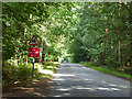
St Neots Road
Presumably named after the school along here.
Image: © Robin Webster
Taken: 26 Aug 2017
0.09 miles
4
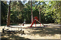
Play Area in the Woods
A nice place for the kids to enjoy under the trees at Lower Common.
Image: © Des Blenkinsopp
Taken: 13 Aug 2022
0.14 miles

6
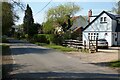
Lower Common, Eversley
There are houses on the northern side of the road, whilst it is mostly woodland to the south.
Image: © Andrew Smith
Taken: 11 Apr 2020
0.22 miles
7

Pond at Warbrook House, Eversley
In the grounds of Warbrook House, Eversley, is a water complex which lies on the centreline of the rear face of the house.
Image: © Len Williams
Taken: 31 Aug 2012
0.24 miles