
IMAGES TAKEN NEAR TO
Churchill Close, TADLEY, RG26 3NH
Introduction
This page details the photographs taken nearby to Churchill Close, RG26 3NH by members of the Geograph project.
The Geograph project started in 2005 with the aim of publishing, organising and preserving representative images for every square kilometre of Great Britain, Ireland and the Isle of Man.

There are currently over 7.5m images from over14,400 individuals and you can help contribute to the project by visiting https://www.geograph.org.uk
Image Map
Images are licensed for reuse under creativecommons.org/licenses/by-sa/2.0
Notes
- Clicking on the map will re-center to the selected point.
- The higher the marker number, the further away the image location is from the centre of the postcode.
Image Listing (18 Images Found)
Images are licensed for reuse under creativecommons.org/licenses/by-sa/2.0
Image
Details
Distance
1
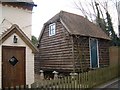
Staddle Stones
This former farm building at Vine Tree Farm, Winston Avenue, Tadley, is raised up on staddle stones - a device used to prevent rats and mice from eating the grain stored in the building. Although staddle stones have often been pillaged to become garden ornaments, there are still a few such buildings in Tadley.
Image: © David Exworth
Taken: 5 Mar 2006
0.05 miles
2
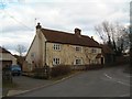
Vine Tree Farm
The picture was taken looking east across Fairlawn Road to Winston Avenue, where this former farmhouse is situated.
Image: © David Exworth
Taken: 5 Mar 2006
0.05 miles
4
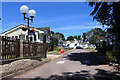
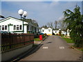
Sleepy Hollow, Tadley
A secluded estate of bungalows at the end of Forest Lane.
Image: © Des Blenkinsopp
Taken: 9 Jul 2022
0.10 miles
5
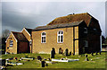
Tadley United Reformed Chapel
Grade 2 listed building erected in 1718.
Image: © Michael FORD
Taken: Unknown
0.16 miles
6
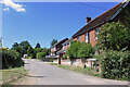
Manse Lane, Tadley
Tadley developed into a large suburb during the second half of the 20th century but this is one of the original old lanes which were here before.
Image: © Des Blenkinsopp
Taken: 9 Jul 2022
0.20 miles
7
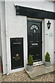
Old post office, old post box
This house on Tadley Hill is called The Old Post Office, because it is. In the wall is a large former post box, of George V vintage (1910-1936), presumably painted black to try to dissuade anyone from trying to put letters into it.
Image: © Graham Horn
Taken: 5 Jun 2011
0.20 miles

10

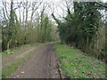
Tadley 'Old Meeting'
After the mediaeval Parish Church, this is the oldest religious building still in use in Tadley, and is situated beside the A340 in the original part of the village. The Meeting House was built in three distinct styles/periods, as can be seen here at the back. The bulk of the building looks as if it may have originally been a barn, a commonly utilised building for 'Non-conformist' chapels in earlier times.
Image: © David Exworth
Taken: 5 Mar 2006
0.22 miles