IMAGES TAKEN NEAR TO
Simons Close, BASINGSTOKE, RG24 8ZF
Introduction
This page details the photographs taken nearby to Simons Close, RG24 8ZF by members of the Geograph project.
The Geograph project started in 2005 with the aim of publishing, organising and preserving representative images for every square kilometre of Great Britain, Ireland and the Isle of Man.

There are currently over 7.5m images from over14,400 individuals and you can help contribute to the project by visiting https://www.geograph.org.uk
Image Map
Images are licensed for reuse under creativecommons.org/licenses/by-sa/2.0
Notes
- Clicking on the map will re-center to the selected point.
- The higher the marker number, the further away the image location is from the centre of the postcode.
Image Listing (110 Images Found)
Images are licensed for reuse under creativecommons.org/licenses/by-sa/2.0
Image
Details
Distance
2

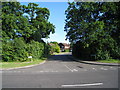
Reading Road - Chineham
An extra lane is being built along the A33 to ease congestion during the rush hour.
Image: © Fernweh
Taken: 4 Jan 2018
0.07 miles
3
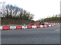
Work on the A33 - Chineham
Looking into the Reading Road which leads into the Chineham housing estate.
Image: © Fernweh
Taken: 4 Jan 2018
0.08 miles
4

Road works on the A33 - Chineham
Adding an extra lane to ease traffic jams during peak periods.
Image: © Fernweh
Taken: 4 Jan 2018
0.08 miles
5
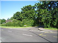
Hartswood / Reading Road
On the eastern fringe of the Chineham housing development.
Image: © Mr Ignavy
Taken: 13 Jul 2009
0.08 miles
6
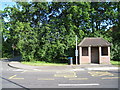
Brick bus shelter
Reading Road (though now just part of the Chineham housing estate).
Image: © Mr Ignavy
Taken: 13 Jul 2009
0.09 miles
7

A33 direction Reading
Exiting the Chineham roundabout.
Image: © Fernweh
Taken: 4 Jan 2018
0.09 miles