IMAGES TAKEN NEAR TO
Poppy Field, BASINGSTOKE, RG24 8TJ
Introduction
This page details the photographs taken nearby to Poppy Field, RG24 8TJ by members of the Geograph project.
The Geograph project started in 2005 with the aim of publishing, organising and preserving representative images for every square kilometre of Great Britain, Ireland and the Isle of Man.

There are currently over 7.5m images from over14,400 individuals and you can help contribute to the project by visiting https://www.geograph.org.uk
Image Map
Images are licensed for reuse under creativecommons.org/licenses/by-sa/2.0
Notes
- Clicking on the map will re-center to the selected point.
- The higher the marker number, the further away the image location is from the centre of the postcode.
Image Listing (42 Images Found)
Images are licensed for reuse under creativecommons.org/licenses/by-sa/2.0
Image
Details
Distance
1
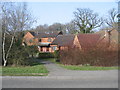
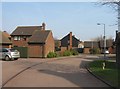
Poppy Fields
Daneshill housing as seen from Great Binfields Road.
Image: © Mr Ignavy
Taken: 21 Mar 2009
0.00 miles
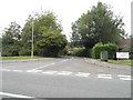
2
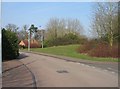
Feld Way
Looking towards Great Binfields Road.
Image: © Mr Ignavy
Taken: 21 Mar 2009
0.05 miles
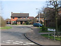
5
Little Fallow
Modern housing in Little Basing.
Image: © Mr Ignavy
Taken: 21 Mar 2009
0.10 miles
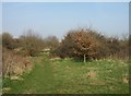
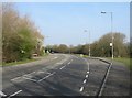
9
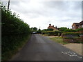
Bartons Lane, Little Basing
National Cycle Route 23.
Image: © JThomas
Taken: 27 Jul 2022
0.13 miles
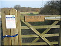
10
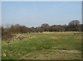
View into the middle of Mill Field
A local nature reserve just off Bartons Lane.
Image: © Mr Ignavy
Taken: 21 Mar 2009
0.14 miles