IMAGES TAKEN NEAR TO
Sheppard Road, BASINGSTOKE, RG21 3HT
Introduction
This page details the photographs taken nearby to Sheppard Road, RG21 3HT by members of the Geograph project.
The Geograph project started in 2005 with the aim of publishing, organising and preserving representative images for every square kilometre of Great Britain, Ireland and the Isle of Man.

There are currently over 7.5m images from over14,400 individuals and you can help contribute to the project by visiting https://www.geograph.org.uk
Image Map
Images are licensed for reuse under creativecommons.org/licenses/by-sa/2.0
Notes
- Clicking on the map will re-center to the selected point.
- The higher the marker number, the further away the image location is from the centre of the postcode.
Image Listing (123 Images Found)
Images are licensed for reuse under creativecommons.org/licenses/by-sa/2.0
Image
Details
Distance
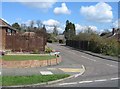

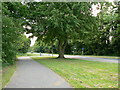
7
Cycleway 23 to Hatch Warren
Crossing the Cliddesden Road by the Golden Lion roundabout.
Image: © Mr Ignavy
Taken: 8 Apr 2008
0.06 miles
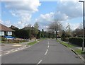
10
Cycleway crossing - Harrow Way
Fully automated. When I stopped to take a photo the sensors picked me up and stopped the traffic. I didn't want to cross the road at that point.
Image: © Mr Ignavy
Taken: 24 May 2008
0.07 miles