
IMAGES TAKEN NEAR TO
Bedwyn Mews, READING, RG2 0PQ
Introduction
This page details the photographs taken nearby to Bedwyn Mews, RG2 0PQ by members of the Geograph project.
The Geograph project started in 2005 with the aim of publishing, organising and preserving representative images for every square kilometre of Great Britain, Ireland and the Isle of Man.

There are currently over 7.5m images from over14,400 individuals and you can help contribute to the project by visiting https://www.geograph.org.uk
Image Map
Images are licensed for reuse under creativecommons.org/licenses/by-sa/2.0
Notes
- Clicking on the map will re-center to the selected point.
- The higher the marker number, the further away the image location is from the centre of the postcode.
Image Listing (52 Images Found)
Images are licensed for reuse under creativecommons.org/licenses/by-sa/2.0
Image
Details
Distance
1
From under ?250K
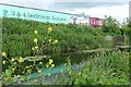
Advertisement for new houses in the Kennet Island development, adjacent to Foudry Brook. The A33 runs behind. The yellow flower looks like escaped oilseed rape (thanks to Anne Burgess for this prognosis).
Image: © Graham Horn
Taken: 15 Jun 2008
0.05 miles
2
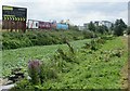
A carpet of floating pennywort in Foudry Brook
This invasive aquatic plant has formed a continuous cover on the surface of Foudry Brook alongside the new housing development at Kennet Island. The hoardings advertising the new houses are those seen in Image The difference in abundance of floating pennywort between the two pictures is clear.
Image: © Simon Mortimer
Taken: 18 Aug 2009
0.05 miles
3
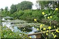
Foudry Brook
Despite the pipes and the urban environment, Foudry Brook can be remarkably attractive in most parts. The yellow flower looks like escaped oilseed rape.
Image: © Graham Horn
Taken: 15 Jun 2008
0.07 miles
4

Northbound A33, Reading
The road was in the process of being resurfaced, although there was no activity at this time.
Image: © Robin Webster
Taken: 18 Jul 2021
0.09 miles
5
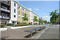
Whale Avenue, Whitley
At the heart of a residential area with apartments as the main accommodation. Outdoor seating like these benches in a traffic free bit of street are here for those who want to get out of the house a bit.
Image: © Des Blenkinsopp
Taken: 15 May 2023
0.13 miles
6

Water feature, Kennet Island, Reading
The water feature in the Central Plaza of Kennet Island in Reading
Image: © Chris Wood
Taken: 11 Oct 2015
0.14 miles
7

Foudry Brook, Reading
The flooded stream has taken on the proportions of a river beside the A33. A cycle track is usually available at the foot of the grass bank. The viewpoint is a bridge which gives access to the new Kennet Island development.
Image: © Andrew Smith
Taken: 17 Jan 2008
0.14 miles
8

The A33, Reading
This is the busiest route into or (preferably) out of the town. The dual carriageway was built a few years ago to take traffic off the Basingstoke Road, now the B3031.
Image: © Andrew Smith
Taken: 29 Nov 2007
0.14 miles
9

Foudry Brook, south of its junction with the Kennet
The plant is the invasive alien water weed Hydrocotyle ranunculoides [floating pennywort]. Thanks to Mick Crawley for the identification.
Image: © Christine Johnstone
Taken: 5 Oct 2013
0.14 miles
10
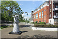
Lindisfarne Way, Whitley
One of several traffic free streets in this residential area.
Image: © Des Blenkinsopp
Taken: 15 May 2023
0.14 miles