
IMAGES TAKEN NEAR TO
Manor Farm Road, READING, RG2 0JN
Introduction
This page details the photographs taken nearby to Manor Farm Road, RG2 0JN by members of the Geograph project.
The Geograph project started in 2005 with the aim of publishing, organising and preserving representative images for every square kilometre of Great Britain, Ireland and the Isle of Man.

There are currently over 7.5m images from over14,400 individuals and you can help contribute to the project by visiting https://www.geograph.org.uk
Image Map
Images are licensed for reuse under creativecommons.org/licenses/by-sa/2.0
Notes
- Clicking on the map will re-center to the selected point.
- The higher the marker number, the further away the image location is from the centre of the postcode.
Image Listing (36 Images Found)
Images are licensed for reuse under creativecommons.org/licenses/by-sa/2.0
Image
Details
Distance
1
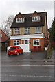
'Little Kingdom Daycare', #313 Basingstoke Road
There is an OS benchmark Image on the right hand side of the house beside the gate in the archway
Image: © Roger Templeman
Taken: 4 Feb 2014
0.05 miles
2
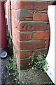
Benchmark on #313 Basingstoke Road
Ordnance Survey cut mark benchmark described on the Bench Mark Database at http://www.bench-marks.org.uk/bm53715
Image: © Roger Templeman
Taken: 4 Feb 2014
0.05 miles
3
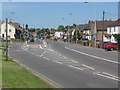
Basingstoke Rd, Reading
View looking north from the bus stop outside Morrisons supermarket (still known to many locals as the old Safeway) on Basingstoke Rd (B3031) in Reading.
Image: © Chris Matson
Taken: 3 Jun 2006
0.07 miles
5
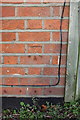
Benchmark on #446 Basingstoke Road
Ordnance Survey cut mark benchmark described on the Bench Mark Database at http://www.bench-marks.org.uk/bm28773
Image: © Roger Templeman
Taken: 21 Jan 2014
0.13 miles
6
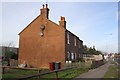
An isolated pair of semi-detached houses on Basingstoke Road
There is an OS database Image on the near corner of the house right of the grey wheelie bin
Image: © Roger Templeman
Taken: 21 Jan 2014
0.13 miles
7

#9 Brixham Road
There is an OS benchmark Image on the side of the near corner of the house, by the bush
Image: © Roger Templeman
Taken: 21 Jan 2014
0.14 miles
8

Benchmark on #9 Brixham Road
Ordnance Survey cut mark benchmark described on the Bench Mark Database at http://www.bench-marks.org.uk/bm28774
Image: © Roger Templeman
Taken: 21 Jan 2014
0.14 miles
9
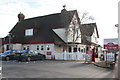
'World Turned Upside Down' pub, Basingstoke Road
Image: © Roger Templeman
Taken: 21 Jan 2014
0.14 miles
10

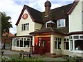
World Turned Upside Down (1), 387 Basingstoke Road, Reading
This unusually named pub/restaurant was a Crown Carvery when photographed in April 2015. It later closed for refurbishment and in March 2017 it reopened as a Stonehouse Pizza & Carvery.
Image
Image: © P L Chadwick
Taken: 19 Apr 2015
0.15 miles