
IMAGES TAKEN NEAR TO
Longships Way, READING, RG2 0FZ
Introduction
This page details the photographs taken nearby to Longships Way, RG2 0FZ by members of the Geograph project.
The Geograph project started in 2005 with the aim of publishing, organising and preserving representative images for every square kilometre of Great Britain, Ireland and the Isle of Man.

There are currently over 7.5m images from over14,400 individuals and you can help contribute to the project by visiting https://www.geograph.org.uk
Image Map
Images are licensed for reuse under creativecommons.org/licenses/by-sa/2.0
Notes
- Clicking on the map will re-center to the selected point.
- The higher the marker number, the further away the image location is from the centre of the postcode.
Image Listing (53 Images Found)
Images are licensed for reuse under creativecommons.org/licenses/by-sa/2.0
Image
Details
Distance
1
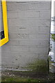
Benchmark on P&G Reading Plant, Manor Farm Road
Ordnance Survey cut mark benchmark described on the Bench Mark Database at http://www.bench-marks.org.uk/bm53717
Image: © Roger Templeman
Taken: 4 Feb 2014
0.05 miles
2

Fair Isle Way, Kennet Island, Reading
The roads in this part of the development are named after small islands, including some quite obscure ones.
Image: © Andrew Smith
Taken: 1 Dec 2020
0.05 miles
3

P&G Reading Plant warehouse
There is an OS benchmark Image on the near corner of the building to the right of and under 'Gillette Goods In' sign
Image: © Roger Templeman
Taken: 4 Feb 2014
0.07 miles
4

Brunel Trading Estate
The Reading Borough Council depot in Bennet Road. This square is largely made up of small factories and warehouses. The image itself is a repeat of one previously rejected - this one taken on a fairly sunny day.
Image: © Rosalind Mitchell
Taken: 25 May 2005
0.07 miles
5

Water feature, Kennet Island, Reading
The water feature in the Central Plaza of Kennet Island in Reading
Image: © Chris Wood
Taken: 11 Oct 2015
0.11 miles
6

Hilbre Walk play area
The play area on Hilbre Walk, between Commercial Road and Rushley Way in Kennet Island.
Image: © Oscar
Taken: 2 Sep 2019
0.12 miles
7

Hilbre Walk
Looking north on Hilbre Walk towards Rushley Way.
Image: © Oscar
Taken: 5 Nov 2019
0.12 miles
8
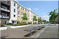
Whale Avenue, Whitley
At the heart of a residential area with apartments as the main accommodation. Outdoor seating like these benches in a traffic free bit of street are here for those who want to get out of the house a bit.
Image: © Des Blenkinsopp
Taken: 15 May 2023
0.13 miles
9

Kennet Island, Reading
A view of Kennet Island development from a building on Darwin Close, with a view of Commercial Road. The development is between Whitley and the A33.
Image: © Oscar Taylor
Taken: 12 Dec 2019
0.13 miles
10

Benchmark on James White Engineering, Commercial Road
Ordnance Survey cut mark benchmark described on the Bench Mark Database at http://www.bench-marks.org.uk/bm53719
Image: © Roger Templeman
Taken: 4 Feb 2014
0.13 miles