
IMAGES TAKEN NEAR TO
Tippett Rise, READING, RG2 0DZ
Introduction
This page details the photographs taken nearby to Tippett Rise, RG2 0DZ by members of the Geograph project.
The Geograph project started in 2005 with the aim of publishing, organising and preserving representative images for every square kilometre of Great Britain, Ireland and the Isle of Man.

There are currently over 7.5m images from over14,400 individuals and you can help contribute to the project by visiting https://www.geograph.org.uk
Image Map
Images are licensed for reuse under creativecommons.org/licenses/by-sa/2.0
Notes
- Clicking on the map will re-center to the selected point.
- The higher the marker number, the further away the image location is from the centre of the postcode.
Image Listing (81 Images Found)
Images are licensed for reuse under creativecommons.org/licenses/by-sa/2.0
Image
Details
Distance
1

Houses at Elgar Road / Waterloo Road junction
Image: © Roger Templeman
Taken: 30 Jun 2014
0.07 miles
2
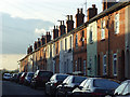
Waldeck Street, Reading
Typical terraced houses of the area. The road is a cul-de-sac.
Image: © Andrew Smith
Taken: 18 Nov 2008
0.07 miles
3

Houses of Collis Street at Waterloo Road junction
There is an OS benchmark Image on the front of the nearest house below the white utilities cabinet right of the front door
Image: © Roger Templeman
Taken: 30 Jun 2014
0.07 miles
4

Benchmark on #1 Collis Street
Ordnance Survey cut mark benchmark described on the Bench Mark Database at http://www.bench-marks.org.uk/bm58420
Image: © Roger Templeman
Taken: 30 Jun 2014
0.07 miles
5

Benchmark on #81 Elgar Road
Ordnance Survey cut mark benchmark described on the Bench Mark Database at http://www.bench-marks.org.uk/bm58419
Image: © Roger Templeman
Taken: 30 Jun 2014
0.08 miles
6

Houses on Elgar Road at Dale Road junction
There is an OS benchmark Image on the front of the house right of the black downpipe and behind its railings
Image: © Roger Templeman
Taken: 30 Jun 2014
0.08 miles
7

Back garden mooring, River Kennet
The houses are in Elgar Road, on the east [non-towpath] bank of the navigation.
Image: © Christine Johnstone
Taken: 6 Oct 2013
0.10 miles
8

Aveley Walk
A road in Katesgrove, Reading.
Image: © Oscar Taylor
Taken: 27 Jan 2022
0.10 miles
9
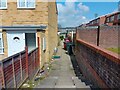
Alleyway off Mellor Walk
One of the many alleyways or "rat runs" on the estate in Katesgrove, in need of a litter pick. This alleyway runs from Mellor Walk to Aveley Walk.
Image: © Oscar Taylor
Taken: 17 Apr 2023
0.12 miles
10

Houses beside the Kennet, Reading
Houses on Elgar Road viewed from the western bank of the river.
Image: © Andrew Smith
Taken: 11 Dec 2007
0.12 miles