
IMAGES TAKEN NEAR TO
Tintern Crescent, READING, RG1 6HB
Introduction
This page details the photographs taken nearby to Tintern Crescent, RG1 6HB by members of the Geograph project.
The Geograph project started in 2005 with the aim of publishing, organising and preserving representative images for every square kilometre of Great Britain, Ireland and the Isle of Man.

There are currently over 7.5m images from over14,400 individuals and you can help contribute to the project by visiting https://www.geograph.org.uk
Image Map
Images are licensed for reuse under creativecommons.org/licenses/by-sa/2.0
Notes
- Clicking on the map will re-center to the selected point.
- The higher the marker number, the further away the image location is from the centre of the postcode.
Image Listing (46 Images Found)
Images are licensed for reuse under creativecommons.org/licenses/by-sa/2.0
Image
Details
Distance
1
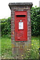
Pillar box with benchmark, St Saviour's Road
Ordnance Survey cut mark benchmark described on the Bench Mark Database at http://www.bench-marks.org.uk/bm55146
Image: © Roger Templeman
Taken: 27 Jun 2014
0.05 miles
2
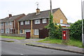
Letter box and houses on St Saviour's Road
There is an OS benchmark Image on the pillar of the letter box
Image: © Roger Templeman
Taken: 27 Jun 2014
0.05 miles
3

Benchmark on #129 St Saviour's Road
Ordnance Survey cut mark benchmark described on the Bench Mark Database at http://www.bench-marks.org.uk/bm55147
Image: © Roger Templeman
Taken: 27 Jun 2014
0.08 miles
4

#129 St Saviour's Road
There is an OS benchmark Image on the side of the house about 2 feet past the junction of the house with its porch extension
Image: © Roger Templeman
Taken: 27 Jun 2014
0.09 miles
5
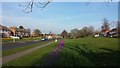
Tulips and Daffodils in Coley Park
Tulips and Daffodils in Coley Park on March 8, 2014
Image: © Chris Wood
Taken: 8 Mar 2014
0.09 miles
6
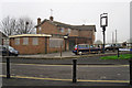
The Roundhead pub, boarded up
Public house on Wensley Road built in the 1960s. According to the Lost Pubs Project http://www.closedpubs.co.uk/berkshire/reading_roundhead.html it closed in 2012.
Taken on an unusually foggy morning.
Image: © Rose and Trev Clough
Taken: 1 Apr 2014
0.10 miles
7
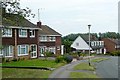
St. Saviour's Road
This is the western end of the road, which forms a long crescent of Wensley Road.Many of the houses are three-bedroomed semis such as here.
Image: © Graham Horn
Taken: 12 Jun 2009
0.10 miles
8
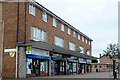
Wensley Road shops
A typical local shopping parade with a pharmacy, a newsagent, an off-licence and, just beyond, a pub.
Image: © Graham Horn
Taken: 12 Jun 2009
0.10 miles

10
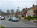
St Saviour's Road, Reading
In the residential area of Coley Park. The estate's three tower blocks are in the background and in less pleasant surroundings.
Image: © Andrew Smith
Taken: 14 Mar 2008
0.11 miles