
IMAGES TAKEN NEAR TO
Addington Road, READING, RG1 5PW
Introduction
This page details the photographs taken nearby to Addington Road, RG1 5PW by members of the Geograph project.
The Geograph project started in 2005 with the aim of publishing, organising and preserving representative images for every square kilometre of Great Britain, Ireland and the Isle of Man.

There are currently over 7.5m images from over14,400 individuals and you can help contribute to the project by visiting https://www.geograph.org.uk
Image Map
Images are licensed for reuse under creativecommons.org/licenses/by-sa/2.0
Notes
- Clicking on the map will re-center to the selected point.
- The higher the marker number, the further away the image location is from the centre of the postcode.
Image Listing (47 Images Found)
Images are licensed for reuse under creativecommons.org/licenses/by-sa/2.0
Image
Details
Distance
1
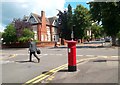
Alexandra Road
Crossing with Addington Road.
Image: © Des Blenkinsopp
Taken: 5 Jul 2012
0.03 miles
2
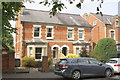
#15 and #17 Addington Road
There is an OS benchmark Image at the base of the wall pier at the left hand side of the gateway at the left hand side of the image
Image: © Roger Templeman
Taken: 2 Jul 2014
0.04 miles
3
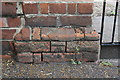
Benchmark on boundary wall of #15 Addington Road
Ordnance Survey cut mark benchmark described on the Bench Mark Database at http://www.bench-marks.org.uk/bm32527
Image: © Roger Templeman
Taken: 2 Jul 2014
0.04 miles
4
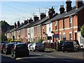
Donnington Gardens, Reading
Looking up the street from Erleigh Road. This is just north of the university and is a studenty area.
Image: © Andrew Smith
Taken: 4 Sep 2007
0.04 miles
5
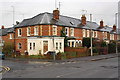
Junction of Donnington Gardens and Addington Road
Image: © Roger Templeman
Taken: 15 Jan 2014
0.07 miles
6

Buildings at Reading School, Addington Road
There is an OS benchmark Image on the corner buttress of the building just the other side of the safety fence
Image: © Roger Templeman
Taken: 15 Jan 2014
0.07 miles
7

Benchmark on Reading School building, Addington Road
Ordnance Survey cut mark benchmark described on the Bench Mark Database at http://www.bench-marks.org.uk/bm32528
Image: © Roger Templeman
Taken: 15 Jan 2014
0.08 miles
8
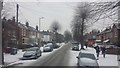
Snow in Addington Road
Snow in Addington Road at 09:47 on 1 March 2018
Image: © Chris Wood
Taken: 1 Mar 2018
0.10 miles
9
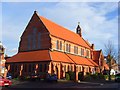
St Luke's, Reading
A Victorian church in Erleigh Road built to serve the area's growing population in 1882. It replaced a short-lived "Iron Church" on a nearby site.
Image: © Andrew Smith
Taken: 5 Dec 2008
0.10 miles
10
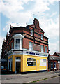
The Wash Box Launderette
I admit to liking brightly painted buildings, although some members of the Victorian Society might cringe at what's gone on here.
But just see the details of the brickwork and ornamentation on what is after all just a suburban end of terrace. The gables,chimneys, the corner window and even the single story bit at the side. Any excuse for a bit of flamboyance.
Reading has so much of this sort of stuff.
I wonder if this was a pub originally. I've tried to make out what's written on the wall under the chimney but it's too far gone.
Image: © Des Blenkinsopp
Taken: 13 Jun 2010
0.11 miles