
IMAGES TAKEN NEAR TO
Upper Redlands Road, READING, RG1 5JT
Introduction
This page details the photographs taken nearby to Upper Redlands Road, RG1 5JT by members of the Geograph project.
The Geograph project started in 2005 with the aim of publishing, organising and preserving representative images for every square kilometre of Great Britain, Ireland and the Isle of Man.

There are currently over 7.5m images from over14,400 individuals and you can help contribute to the project by visiting https://www.geograph.org.uk
Image Map
Images are licensed for reuse under creativecommons.org/licenses/by-sa/2.0
Notes
- Clicking on the map will re-center to the selected point.
- The higher the marker number, the further away the image location is from the centre of the postcode.
Image Listing (30 Images Found)
Images are licensed for reuse under creativecommons.org/licenses/by-sa/2.0
Image
Details
Distance
1
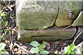
Benchmark on St William of York Church
Ordnance Survey cut mark benchmark described on the Bench Mark Database at http://www.bench-marks.org.uk/bm58537
Image: © Roger Templeman
Taken: 2 Jul 2014
0.09 miles
2
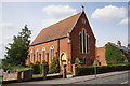
St William of York Church, Upper Redlands Road
There is an OS benchmark Image on the inside face of the buttress on the near corner of the church
Image: © Roger Templeman
Taken: 2 Jul 2014
0.09 miles
3
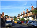
Cardigan Gardens, Reading
A short road linking the tops of Foxhill Road and Cardigan Road. In the area of terraced houses north of the University.
Image: © Andrew Smith
Taken: 21 Jul 2008
0.09 miles
4
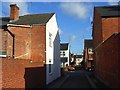
Lydford Road, Reading
Lydford Road is a narrow road that connects a series of terraced street that run perpendicular to it. I doesn't appear that any houses have addresses on the road itself. A wall facing the camera has a faded advertisement reading "Collins's Celebrated..."
Image: © Andrew Smith
Taken: 24 Nov 2008
0.09 miles
5
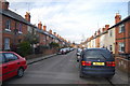
Blenheim Gardens
One of a number of streets of terraced housing in this part of Reading.
Image: © Trevor Harris
Taken: 28 Nov 2010
0.10 miles
6

Elmhurst Road at the junction of Upper Redlands Road
Image: © David Howard
Taken: 18 Feb 2019
0.12 miles
7
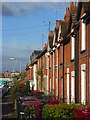
Cardigan Road, Reading
A typical terrace leading down to Addington Road with small front gardens and resident wheely-bins.
Image: © Andrew Smith
Taken: 24 Nov 2008
0.13 miles
8
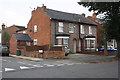
Junction of Addington Road and Blenheim Gardens
Changed boundary wall of #60 Addington Road has resulted in loss of Ordnance Survey benchmark on the corner
Image: © Roger Templeman
Taken: 19 Sep 2016
0.15 miles
9
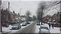
Snow in Addington Road
Snow in Addington Road at 09:47 on 1 March 2018
Image: © Chris Wood
Taken: 1 Mar 2018
0.15 miles
10
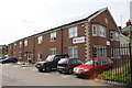
John Nike House, #90 Eastern Avenue
This British Red Cross building replaced a warehouse previously on the site and was opened by Princess Alexandra on 3 November 2010
Image: © Roger Templeman
Taken: 2 Jul 2014
0.16 miles