
IMAGES TAKEN NEAR TO
Kings Road, READING, RG1 4JG
Introduction
This page details the photographs taken nearby to Kings Road, RG1 4JG by members of the Geograph project.
The Geograph project started in 2005 with the aim of publishing, organising and preserving representative images for every square kilometre of Great Britain, Ireland and the Isle of Man.

There are currently over 7.5m images from over14,400 individuals and you can help contribute to the project by visiting https://www.geograph.org.uk
Image Map
Images are licensed for reuse under creativecommons.org/licenses/by-sa/2.0
Notes
- Clicking on the map will re-center to the selected point.
- The higher the marker number, the further away the image location is from the centre of the postcode.
Image Listing (179 Images Found)
Images are licensed for reuse under creativecommons.org/licenses/by-sa/2.0
Image
Details
Distance
1
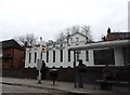
The Sardar Palace Indian restaurant, Reading
The front has clearly been added to a typical Victorian block behind.
Image: © David Howard
Taken: 6 Mar 2016
0.01 miles
2
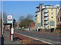
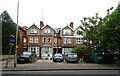
King's Road, Reading
Looking towards the town centre. The apartment block is at the junction with Rupert Street.
Image: © Andrew Smith
Taken: 10 Apr 2008
0.03 miles
3
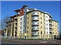
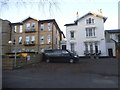
Apartments, King's Road, Reading
One of a numerous blocks that have sprung up locally in recent years. This one occupies the site between Rupert Street and Kingsgate Street where there were previously offices.
Image: © Andrew Smith
Taken: 10 Apr 2008
0.03 miles
7
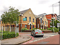
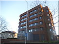
Reading : Rupert Street
From King's Road looking up Rupert Street.
Image: © Lewis Clarke
Taken: 18 Jul 2019
0.04 miles
8

King's Road, Reading
Looking towards the town centre from "Cemetery Junction" - the meeting point of London, Wokingham and King's Roads. The first building on the left is a pub, The Upin Arms. This, and the fast food establishment in the foreground, cater for the local student population. The pub is on the western edge of this grid-square.
Image: © Andrew Smith
Taken: 10 Apr 2008
0.04 miles
9

Reading: the Upin Arms
A pub on Cemetery Junction, with what is presumably a jocular name based on the commonness of 'Arms' in pub names.
Image: © Chris Downer
Taken: 16 Mar 2010
0.04 miles
10
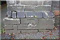
Benchmark on gatepost at entrance to #31 Vanbrugh Court
Ordnance Survey cut mark benchmark described on the Bench Mark Database at http://www.bench-marks.org.uk/bm32460
Image: © Roger Templeman
Taken: 6 May 2014
0.05 miles