
IMAGES TAKEN NEAR TO
Lewis Walk, NEWBURY, RG14 6TB
Introduction
This page details the photographs taken nearby to Lewis Walk, RG14 6TB by members of the Geograph project.
The Geograph project started in 2005 with the aim of publishing, organising and preserving representative images for every square kilometre of Great Britain, Ireland and the Isle of Man.

There are currently over 7.5m images from over14,400 individuals and you can help contribute to the project by visiting https://www.geograph.org.uk
Image Map
Images are licensed for reuse under creativecommons.org/licenses/by-sa/2.0
Notes
- Clicking on the map will re-center to the selected point.
- The higher the marker number, the further away the image location is from the centre of the postcode.
Image Listing (100 Images Found)
Images are licensed for reuse under creativecommons.org/licenses/by-sa/2.0
Image
Details
Distance
1
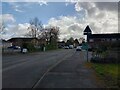
Glendale Avenue
A road between Normay Rise and Villiers Way. The library is to the left.
Image: © Oscar Taylor
Taken: 24 Mar 2023
0.03 miles
2
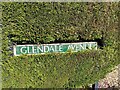
Glendale Avenue sign
A sign for Glendale Avenue, submurged in a hedge.
Image: © Oscar Taylor
Taken: 24 Mar 2023
0.05 miles
3
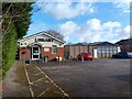
Wash Common library and community centre
The library (left) and community centre (right) in Wash Common on Glendale Avenue.
Image: © Oscar Taylor
Taken: 24 Mar 2023
0.05 miles
4

The Hampdens
A cul-de-sac off Glendale Avenue. Wash Common water tower can be seen behind.
Image: © Oscar Taylor
Taken: 24 Mar 2023
0.06 miles
5
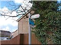
Byway sign off Glendale Avenue
A sign showing the route of the byway running from Glendale Avenue to Battle Road. Despite the narrow access on Glendale Avenue and no possible access on Battle Road, there is a sign saying to "SLOW DOWN" - maybe for bicycles?
Image: © Oscar Taylor
Taken: 24 Mar 2023
0.06 miles
6

Byway between Glendale Avenue and Battle Road
A byway that leads from Glendale Avenue to Battle Road past Wash Common park. The entrance to the byway is narrowed by bollards at this end, and is blocked almost entirely by a gate at the other. A moped would manage.
Image: © Oscar Taylor
Taken: 24 Mar 2023
0.07 miles
7
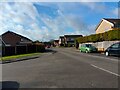
Meyrick Drive
A road between Normay Rise and Villiers Way. The junction to the left leads to Gilroy Close, the junction further ahead to the right leads to Balfour Crescent.
Image: © Oscar Taylor
Taken: 24 Mar 2023
0.07 miles
8
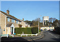
Skippons Close, Wash Common
Two battles during the English Civil War took place at Newbury in 1643 and 1644. This is on part of the 1643 battlefield.
Various streets take their names from these events including the small cul de sac shown here. Philip Skippon was an infantry commander on the Roundhead side during the war, and subsequently a member of the House of Lords during Oliver Cromwell's Parliament. https://en.wikipedia.org/wiki/Philip_Skippon
The adjoining road, Stapleton Close, has a similar story.
Image: © Des Blenkinsopp
Taken: 11 Dec 2018
0.09 miles
9

Alleyway to Skippons Close from byway
Access from the byway to Skippons Close, through a narrow gap between a garage and fenced garden.
Image: © Oscar Taylor
Taken: 24 Mar 2023
0.09 miles
10

Allotments at Wash Common
Part of an area of undeveloped land around a Bronze Age burial site containing several tumuli.
Image: © Des Blenkinsopp
Taken: 11 Dec 2018
0.10 miles