
IMAGES TAKEN NEAR TO
Longacre, NEWBURY, RG14 6DZ
Introduction
This page details the photographs taken nearby to Longacre, RG14 6DZ by members of the Geograph project.
The Geograph project started in 2005 with the aim of publishing, organising and preserving representative images for every square kilometre of Great Britain, Ireland and the Isle of Man.

There are currently over 7.5m images from over14,400 individuals and you can help contribute to the project by visiting https://www.geograph.org.uk
Image Map
Images are licensed for reuse under creativecommons.org/licenses/by-sa/2.0
Notes
- Clicking on the map will re-center to the selected point.
- The higher the marker number, the further away the image location is from the centre of the postcode.
Image Listing (91 Images Found)
Images are licensed for reuse under creativecommons.org/licenses/by-sa/2.0
Image
Details
Distance
1
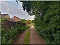
Track between Oaken Grove and Fifth Road
A track between Oaken Grove and Fifth Road in Newbury. It is used by walkers quite often.
Image: © Oscar Taylor
Taken: 29 Jun 2023
0.04 miles
2
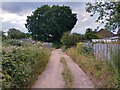
Track between Oaken Grove and Fifth Road
A track between Oaken Grove and Fifth Road in Newbury. It is used by walkers quite often.
Image: © Oscar Taylor
Taken: 29 Jun 2023
0.04 miles
3
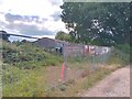
Disused barn near Fifth Road
A disused barn in the corner of a field near to Fifth Road in Newbury. Assumedly it will be demolished for housing at some point.
Image: © Oscar Taylor
Taken: 29 Jun 2023
0.04 miles
4
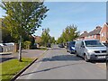
Oaken Grove, Newbury
Oaken Grove is a road off Fifth Road in Newbury, connecting to Long Acre.
Image: © Oscar Taylor
Taken: 3 May 2023
0.04 miles
5
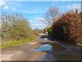
Fifth Road
Very large potholes form this section of Fifth Road, which is unadopted. It is the route of a public footpath.
Image: © Oscar Taylor
Taken: 8 Apr 2023
0.05 miles
6

Track between Oaken Grove and Fifth Road
A track between Oaken Grove and Fifth Road in Newbury. It is used by walkers quite often.
Image: © Oscar Taylor
Taken: 29 Jun 2023
0.05 miles
7

Oaken Grove, Newbury
The south end of Oaken Grove. To the right is the field of John Rankin Primary School.
Image: © Oscar Taylor
Taken: 29 Jun 2023
0.05 miles
8
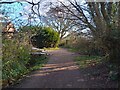
Corner of Oaken Grove
An unadopted road on the edge of Newbury forms a junction with a public footpath here.
Image: © Oscar Taylor
Taken: 8 Apr 2023
0.06 miles
9
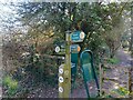
Public footpath signs at Oaken Grove
The route of the public footpath is shown with three signs at the corner of Oaken Grove. There is an access barrier to allow only pedestrians. It is a little pointless as there is a wide gap in the hedge about 10 metres north.
Image: © Oscar Taylor
Taken: 8 Apr 2023
0.06 miles
10

The Oaks driveway, 75 Fifth Road
A very swanky driveway at the end of Oaken Grove leads to 75 Fifth Road (known as "The Oaks").
Image: © Oscar Taylor
Taken: 29 Jun 2023
0.06 miles