
IMAGES TAKEN NEAR TO
Argyle Road, NEWBURY, RG14 6BX
Introduction
This page details the photographs taken nearby to Argyle Road, RG14 6BX by members of the Geograph project.
The Geograph project started in 2005 with the aim of publishing, organising and preserving representative images for every square kilometre of Great Britain, Ireland and the Isle of Man.

There are currently over 7.5m images from over14,400 individuals and you can help contribute to the project by visiting https://www.geograph.org.uk
Image Map
Images are licensed for reuse under creativecommons.org/licenses/by-sa/2.0
Notes
- Clicking on the map will re-center to the selected point.
- The higher the marker number, the further away the image location is from the centre of the postcode.
Image Listing (413 Images Found)
Images are licensed for reuse under creativecommons.org/licenses/by-sa/2.0
Image
Details
Distance
1

Newbury - St Bartholomew's Hospital
Grade II* listed almshouses in Argyle Street.
Image: © Chris Talbot
Taken: 28 Jan 2012
0.00 miles
2

St Bartholomew's Hospital
The almshouses of St Bartholomew's Hospital, now converted into small individual dwellings. The almshouses are a Grade II* listed building, list entry number 1219550 https://historicengland.org.uk/listing/the-list/list-entry/1219550
The gateway and wall shown is a Grade II listed building, list entry number 1219551 https://historicengland.org.uk/listing/the-list/list-entry/1219551
Image: © Oscar Taylor
Taken: 22 Mar 2023
0.00 miles
3

St Bartholomew's Hospital
Almshouses reputedly founded by King John, the present building dates from 1698.
Listing details :- https://britishlistedbuildings.co.uk/101219550-st-bartholomews-hospital-newbury#.W9jNnq2caRs
Image: © Des Blenkinsopp
Taken: 24 Oct 2018
0.01 miles
4

Newbury - St Bartholomew's Hospital
Grade II listed almshouses in Argyle Street.
Image: © Chris Talbot
Taken: 28 Jan 2012
0.01 miles
5

Newbury - Feltre Place
Feltre Place is named after one of the four towns Newbury is twinned with. Feltre is set in the foothills of the Dolomites in the north-east of Italy.
Image: © Chris Talbot
Taken: 28 Jan 2012
0.01 miles
6

St. Bartholomew's hospital
This is detail of the hospital building, above the entrance, dating from the 15th century, although the clock is more recent. The context is here Image]
Image: © Graham Horn
Taken: 31 Jan 2009
0.02 miles
7

Benchmark on #27 Argyle Road
Ordnance Survey cut mark benchmark described on the Bench Mark Database at http://www.bench-marks.org.uk/bm35975
Image: © Roger Templeman
Taken: 6 Nov 2010
0.02 miles
8
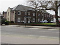
Row of houses on the west side of Newtown Road, Newbury
Between Newtown Road and Argyle Road.
Image: © Jaggery
Taken: 18 Apr 2019
0.02 miles
9
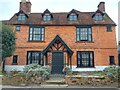
Bartholomew Manor
An early 16th century hall house on Argyle Road. It is a Grade II listed building, list entry number 1291421 https://historicengland.org.uk/listing/the-list/list-entry/1291421
Image: © Oscar Taylor
Taken: 22 Mar 2023
0.02 miles
10
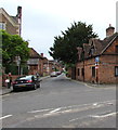
Argyle Road, Newbury
One-way road viewed across Pound Street.
Image: © Jaggery
Taken: 5 Jun 2018
0.02 miles