
IMAGES TAKEN NEAR TO
Rockingham Road, NEWBURY, RG14 5PA
Introduction
This page details the photographs taken nearby to Rockingham Road, RG14 5PA by members of the Geograph project.
The Geograph project started in 2005 with the aim of publishing, organising and preserving representative images for every square kilometre of Great Britain, Ireland and the Isle of Man.

There are currently over 7.5m images from over14,400 individuals and you can help contribute to the project by visiting https://www.geograph.org.uk
Image Map
Images are licensed for reuse under creativecommons.org/licenses/by-sa/2.0
Notes
- Clicking on the map will re-center to the selected point.
- The higher the marker number, the further away the image location is from the centre of the postcode.
Image Listing (288 Images Found)
Images are licensed for reuse under creativecommons.org/licenses/by-sa/2.0
Image
Details
Distance
1

Footpath by the railway
Should bring you out on Bartholomew Street though I'm not sure I'd want to walk along it.
Image: © Bill Nicholls
Taken: 30 Sep 2012
0.01 miles
2

Rockingham Road Bridge
A bridge carrying Rockingham Road over the railway line.
The bridge is a Grade II listed building, list entry number 1409266 https://historicengland.org.uk/listing/the-list/list-entry/1409266
It was only listed in 2012 due to its unique design of being the only example of a Brunel single-span segmental arched bridge with raking abutments, built c.1845 to 1847, when the railway to Reading from Newbury was opened. The bridge spans around 11 metres.
Image: © Oscar Taylor
Taken: 22 Mar 2023
0.02 miles

4
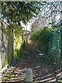
Alleyway beside the railway
An alleyway off Rockingham Road beside the railway.
Image: © Oscar Taylor
Taken: 22 Mar 2023
0.02 miles
5

Benchmark on #2 St Georges Avenue
Ordnance Survey cut mark benchmark described on the Bench Mark Database at http://www.bench-marks.org.uk/bm35967
Image: © Roger Templeman
Taken: 6 Nov 2010
0.02 miles
6

Benchmark on railway bridge on Rockingham Road
Ordnance Survey cut mark benchmark described on the Bench Mark Database at http://www.bench-marks.org.uk/bm35968
Image: © Roger Templeman
Taken: 6 Nov 2010
0.03 miles
7

St Michael's Road
St Michael's Road off Rockingham Road in Newbury
Image: © Bill Nicholls
Taken: 30 Sep 2012
0.03 miles
8

St George's Avenue
St George's Avenue off Rockingham Road in Newbury
Image: © Bill Nicholls
Taken: 30 Sep 2012
0.03 miles
9

St George's Avenue
A road between Rockingham Road and Green Lane. It is known as "the Av" locally as the houses were originally all council owned.
Image: © Oscar Taylor
Taken: 22 Mar 2023
0.03 miles
10

Across Rockingham Road bridge
View across Rockingham Road bridge towards the Enborne Road in Newbury
Image: © Bill Nicholls
Taken: 30 Sep 2012
0.03 miles