
IMAGES TAKEN NEAR TO
Clifton Road, NEWBURY, RG14 5JT
Introduction
This page details the photographs taken nearby to Clifton Road, RG14 5JT by members of the Geograph project.
The Geograph project started in 2005 with the aim of publishing, organising and preserving representative images for every square kilometre of Great Britain, Ireland and the Isle of Man.

There are currently over 7.5m images from over14,400 individuals and you can help contribute to the project by visiting https://www.geograph.org.uk
Image Map
Images are licensed for reuse under creativecommons.org/licenses/by-sa/2.0
Notes
- Clicking on the map will re-center to the selected point.
- The higher the marker number, the further away the image location is from the centre of the postcode.
Image Listing (108 Images Found)
Images are licensed for reuse under creativecommons.org/licenses/by-sa/2.0
Image
Details
Distance
1
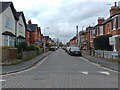
Clifton Road
Clifton Road is a cul-de-sac off Gloucester Road and Chalford Road in West Fields.
Image: © Oscar Taylor
Taken: 15 Apr 2023
0.05 miles
2
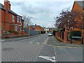
Chalford Road crossroads
The crossroads on Chalford Road, where the road crosses Gloucester Road and Clifton Road.
Image: © Oscar Taylor
Taken: 15 Apr 2023
0.05 miles
3
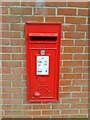
Postbox on Chalford Road
A postbox in a wall on Chalford Road in West Fields.
Image: © Oscar Taylor
Taken: 15 Apr 2023
0.06 miles
4

Newbury West Fields railway Halt (site), Berkshire
Opened in 1906 by the Great Western Railway on the branch line from Newbury to Lambourn, this station closed in 1957.
View south towards Newbury. The site has been comprehensively redeveloped, although the former boundaries can still be clearly seen on modern maps. This viewpoint would have been looking along the single track railway line that ran through where the house in the centre of the image now is, then curving left to join the main line. The single brick-built platform with a 'pagoda' style waiting shelter, was to the left of the track.
Image: © Nigel Thompson
Taken: 10 Mar 2022
0.06 miles
5

Newbury: Site of the former West Fields Halt railway station
The halt, on the Lambourn Valley Railway, was generally located off to the right of this alleyway between Craven and Clifton Roads. It opened in 1906 some eight years after the line to Lambourn was opened, and closed in 1957, some three years before the rest of the line.
Image: © Nigel Cox
Taken: 3 Jan 2010
0.06 miles
6
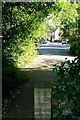
Path to Lipscombe Close
One of a number of paths that lead off the canal tow-path into the western housing areas of Newbury.
Image: © Graham Horn
Taken: 2 Jun 2009
0.08 miles
7

Newbury: Craven Road
Long before the houses were built here, in the West Fields area of Newbury, this was the point at which the former Lambourn Valley Railway crossed the alignment of the road, to be a little more precise somewhere near the greenery on the left. This photograph was taken fifty years to the day, bar one, after the regular passenger and freight services were terminated by British Railways. A short distance away to the left was the site of Image
Image: © Nigel Cox
Taken: 3 Jan 2010
0.08 miles
8
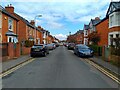
Gloucester Road
Gloucester Road is a road between the crossroads with Chalford Road and Clifton Road and the crossroads with Blenheim Road and Berkeley Road in West Fields.
Image: © Oscar Taylor
Taken: 15 Apr 2023
0.08 miles
9

Parsons Close and Puffers Way
Two short roads in West Fields off Craven Road, both with mostly blocks of flats, with some houses.
Image: © Oscar Taylor
Taken: 15 Apr 2023
0.08 miles
10
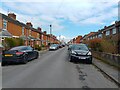
Russell Road
Russell Road is a road between Butson Close and Blenheim Road in West Fields. It also connects to Dysons Close and Chalford Road.
Image: © Oscar Taylor
Taken: 15 Apr 2023
0.09 miles