
IMAGES TAKEN NEAR TO
Gloucester Road, NEWBURY, RG14 5JN
Introduction
This page details the photographs taken nearby to Gloucester Road, RG14 5JN by members of the Geograph project.
The Geograph project started in 2005 with the aim of publishing, organising and preserving representative images for every square kilometre of Great Britain, Ireland and the Isle of Man.

There are currently over 7.5m images from over14,400 individuals and you can help contribute to the project by visiting https://www.geograph.org.uk
Image Map
Images are licensed for reuse under creativecommons.org/licenses/by-sa/2.0
Notes
- Clicking on the map will re-center to the selected point.
- The higher the marker number, the further away the image location is from the centre of the postcode.
Image Listing (143 Images Found)
Images are licensed for reuse under creativecommons.org/licenses/by-sa/2.0
Image
Details
Distance
1
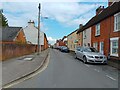
Russell Road
Looking towards the town centre on Russell Road, a road between Butson Close and Blenheim Road in West Fields. It also connects to Dysons Close and Chalford Road.
To the left is a bungalow, 61 Russell Road. A planning application was denied in 2022 for the demolition of the bungalow and erection of 4 dwellings. A planning application for the demolition of the bungalow and erection of 3 dwellings is yet to be decided upon.
Image: © Oscar Taylor
Taken: 15 Apr 2023
0.05 miles
2
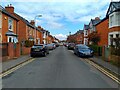
Gloucester Road
Gloucester Road is a road between the crossroads with Chalford Road and Clifton Road and the crossroads with Blenheim Road and Berkeley Road in West Fields.
Image: © Oscar Taylor
Taken: 15 Apr 2023
0.06 miles
3

Dyson Close
Dyson Close is a cul-de-sac off Russell Road in West Fields.
Image: © Oscar Taylor
Taken: 15 Apr 2023
0.07 miles
4

Craven Road
Looking east along Craven Road in West Fields towards the BT tower, which can be seen in the distance.
Image: © Oscar Taylor
Taken: 15 Apr 2023
0.08 miles
5
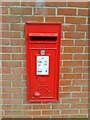
Postbox on Chalford Road
A postbox in a wall on Chalford Road in West Fields.
Image: © Oscar Taylor
Taken: 15 Apr 2023
0.08 miles
6
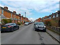
Russell Road
Russell Road is a road between Butson Close and Blenheim Road in West Fields. It also connects to Dysons Close and Chalford Road.
Image: © Oscar Taylor
Taken: 15 Apr 2023
0.08 miles
7
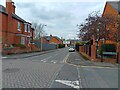
Chalford Road crossroads
The crossroads on Chalford Road, where the road crosses Gloucester Road and Clifton Road.
Image: © Oscar Taylor
Taken: 15 Apr 2023
0.08 miles
8
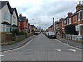
Clifton Road
Clifton Road is a cul-de-sac off Gloucester Road and Chalford Road in West Fields.
Image: © Oscar Taylor
Taken: 15 Apr 2023
0.09 miles
9

Sheltered housing at West Fields
Flats operated by the Sovereign Housing Association, with lovely views from the balconies over the canal towards the water meadows to the north.
Image: © Graham Horn
Taken: 2 Jun 2009
0.10 miles
10

Housing by the Kennet
I think these might be retirement homes which are near the Kennet at Newbury
Image: © Bill Nicholls
Taken: 30 Sep 2012
0.10 miles