
IMAGES TAKEN NEAR TO
Benett Gardens, NEWBURY, RG14 1PW
Introduction
This page details the photographs taken nearby to Benett Gardens, RG14 1PW by members of the Geograph project.
The Geograph project started in 2005 with the aim of publishing, organising and preserving representative images for every square kilometre of Great Britain, Ireland and the Isle of Man.

There are currently over 7.5m images from over14,400 individuals and you can help contribute to the project by visiting https://www.geograph.org.uk
Image Map
Images are licensed for reuse under creativecommons.org/licenses/by-sa/2.0
Notes
- Clicking on the map will re-center to the selected point.
- The higher the marker number, the further away the image location is from the centre of the postcode.
Image Listing (23 Images Found)
Images are licensed for reuse under creativecommons.org/licenses/by-sa/2.0
Image
Details
Distance

2
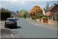
Castle Grove, Newbury
Looking west from the point at which the road transitions from Almond Avenue.
Image: © Andrew Smith
Taken: 2 May 2021
0.09 miles
3
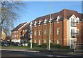
Rennie Court
New homes on the western edge of Newbury.
Image: © Mr Ignavy
Taken: 18 Dec 2011
0.11 miles
4
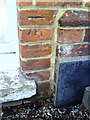
Benchmark on #13 Oxford Road
Ordnance Survey cut mark benchmark described on the Bench Mark Database at http://www.bench-marks.org.uk/bm35959
Image: © Roger Templeman
Taken: 6 Nov 2010
0.12 miles
5
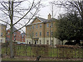
New housing old College
These smart new flats are built on the site of the old Newbury College. It has a new site on the south side of town.
Image: © Stuart Logan
Taken: 28 Feb 2012
0.12 miles
6
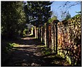
Lane at the back of Donnington Square, Newbury
Running around the back of the Square is a lane which was originally for access to the stabling and for tradesmen and servants. There are a few garages here now as well as some original stabling.
The lane runs right around the back of the square of houses and gardens to emerge at the other end.
Image: © Gillie Rhodes
Taken: 27 Mar 2012
0.12 miles
7
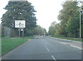
A4 junction with B4494
The A4 is called The Western Avenue at this point and its predecessor, The Old Bath Road, is just to the south nearer the town centre. To the right is Oxford Road.
Image: © Stuart Logan
Taken: 23 Sep 2011
0.14 miles
8

Weir on the river Lambourn
Downstream view. I used to go fishing here as a child.
Image: © Julian Tubb
Taken: 9 Nov 2007
0.16 miles
9

Weir on the river Lambourn
Upstream View. I used to go fishing here as a child
Image: © Julian Tubb
Taken: 9 Nov 2007
0.16 miles
10
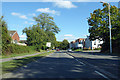
A4 Western Avenue, Newbury
Towards Reading.
Image: © Robin Webster
Taken: 16 Sep 2018
0.17 miles