
IMAGES TAKEN NEAR TO
Amity Road, READING, RG1 3LJ
Introduction
This page details the photographs taken nearby to Amity Road, RG1 3LJ by members of the Geograph project.
The Geograph project started in 2005 with the aim of publishing, organising and preserving representative images for every square kilometre of Great Britain, Ireland and the Isle of Man.

There are currently over 7.5m images from over14,400 individuals and you can help contribute to the project by visiting https://www.geograph.org.uk
Image Map
Images are licensed for reuse under creativecommons.org/licenses/by-sa/2.0
Notes
- Clicking on the map will re-center to the selected point.
- The higher the marker number, the further away the image location is from the centre of the postcode.
Image Listing (141 Images Found)
Images are licensed for reuse under creativecommons.org/licenses/by-sa/2.0
Image
Details
Distance
1

Cumberland Road, Reading
The terraced houses of the New Town area. On the right is the Sikh gurdwara.
Image: © Andrew Smith
Taken: 22 Sep 2007
0.07 miles
2
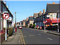
Cholmeley Road, Reading
Leading into the cosmopolitan Newtown area. The shop is on the corner of Radstock Road.
Image: © Andrew Smith
Taken: 3 Mar 2008
0.07 miles
3

House at junction of Norwood Road and Cumberland Road
This house (#31 Cumberland Road) had an Ordnance Survey cut mark benchmark (described on the Bench Mark Database at http://www.bench-marks.org.uk/bm23683 ) on its near corner. The mark has been lost to rendering.
Image: © Roger Templeman
Taken: 21 Jul 2014
0.07 miles
4

Reading : Cumberland Road
Cumberland Road with Reading Stained Glass in view.
Image: © Lewis Clarke
Taken: 18 Jul 2019
0.07 miles

6
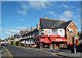
Hargun Superstore
Corner shop with ambition. This is the New Town area of Reading, which as you can see is actually made up of Victorian terraced housing.
Image: © Des Blenkinsopp
Taken: 10 Oct 2013
0.08 miles

8
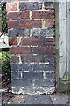
Benchmark on wall of the now demolished The Eastgate pub
Ordnance Survey cut mark benchmark described on the Bench Mark Database at http://www.bench-marks.org.uk/bm23692
Image: © Roger Templeman
Taken: 31 Aug 2011
0.08 miles
9
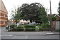
Eastgate Court which has replaced The Eastgate PH
This new development is on Cholmeley Road. The wall pier at RHS of photo retains an OS benchmark Image
Image: © Roger Templeman
Taken: 31 Aug 2011
0.08 miles
10
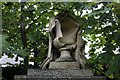
Broken Urn
The top of a memorial broken some time ago from the look in Reading Cemetery.
Image: © Bill Nicholls
Taken: 27 Sep 2014
0.09 miles