
IMAGES TAKEN NEAR TO
River Road, READING, RG1 2NF
Introduction
This page details the photographs taken nearby to River Road, RG1 2NF by members of the Geograph project.
The Geograph project started in 2005 with the aim of publishing, organising and preserving representative images for every square kilometre of Great Britain, Ireland and the Isle of Man.

There are currently over 7.5m images from over14,400 individuals and you can help contribute to the project by visiting https://www.geograph.org.uk
Image Map
Images are licensed for reuse under creativecommons.org/licenses/by-sa/2.0
Notes
- Clicking on the map will re-center to the selected point.
- The higher the marker number, the further away the image location is from the centre of the postcode.
Image Listing (441 Images Found)
Images are licensed for reuse under creativecommons.org/licenses/by-sa/2.0
Image
Details
Distance
1

Katesgrove Lane
To see why this sign is significant see Image]
Image: © Graham Horn
Taken: 29 May 2009
0.02 miles
2

Bridge over River Kennet, Berkeley Avenue
There is an OS benchmark Image on the brick pier at the near end of the bridge
Image: © Roger Templeman
Taken: 27 Jun 2014
0.02 miles
3

Tree on Pell Road, Reading
Although Pell Road is the A4 Reading council do all they can to deter drivers from using it, including not using any road signs. It is still the most direct route west from the A329 as the others send you on a circular route.
Image: © David Howard
Taken: 7 Aug 2016
0.02 miles
4

Benchmark on River Kennet Bridge
Ordnance Survey cut mark benchmark described on the Bench Mark Database at http://www.bench-marks.org.uk/bm58417
Image: © Roger Templeman
Taken: 27 Jun 2014
0.02 miles
5

Reading: bridge maker?s badge
I was stopped at temporary traffic lights on the A4 on this bridge over the river – and noticed this rather ornate badge on the northern parapet (there is one on the southern side, too).
Image: © Chris Downer
Taken: 16 Mar 2010
0.02 miles
6

Kennet & Avon Canal Walk
Kennet & Avon Canal Walk at Berkeley Avenue Bridge No 5
Image: © Shaun Ferguson
Taken: 15 Jul 2017
0.02 miles
7

Berkeley Avenue
To see why this sign is significant see Image]
Image: © Graham Horn
Taken: 29 May 2009
0.03 miles
8

A street, a road, an avenue, a lane
This is possibly a unique junction. The four links are Pell Street, Elgar Road, Berkeley Avenue and Katesgrove Lane, believed to be the only place in Britain where four different types of highway name meet at one place.
This tree is on the corner of Elgar Road (left) and Berkeley Avenue (right). For the next corner see Image]
Image: © Graham Horn
Taken: 29 May 2009
0.03 miles
9
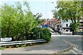
Entrance to Temple Place
Yet another variation of road name, adjacent to the crossroads ahead where a street, a road an avenue and a lane meet. See Image]
Image: © Graham Horn
Taken: 29 May 2009
0.03 miles
10

A street, a road, an avenue, a lane
This is possibly a unique junction. The four links are Pell Street, Elgar Road, Berkeley Avenue and Katesgrove Lane, believed to be the only place in Britain where four different types of highway name meet at one place.
This is the north-west corner with Berkeley Avenue (left) and Katesgrove Lane (right). For the next corner see Image]
Image: © Graham Horn
Taken: 29 May 2009
0.03 miles