
IMAGES TAKEN NEAR TO
Rowley Close, BRACKNELL, RG12 9TJ
Introduction
This page details the photographs taken nearby to Rowley Close, RG12 9TJ by members of the Geograph project.
The Geograph project started in 2005 with the aim of publishing, organising and preserving representative images for every square kilometre of Great Britain, Ireland and the Isle of Man.

There are currently over 7.5m images from over14,400 individuals and you can help contribute to the project by visiting https://www.geograph.org.uk
Image Map
Images are licensed for reuse under creativecommons.org/licenses/by-sa/2.0
Notes
- Clicking on the map will re-center to the selected point.
- The higher the marker number, the further away the image location is from the centre of the postcode.
Image Listing (25 Images Found)
Images are licensed for reuse under creativecommons.org/licenses/by-sa/2.0
Image
Details
Distance
1
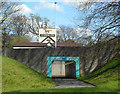
Subway to the Running Horse
This is in the middle of a busy roundabout which cyclists and walkers cross easily and safely via the subways.
The top of The Running Horse pub peers over the wall.
Image: © Des Blenkinsopp
Taken: 3 Apr 2017
0.09 miles
2
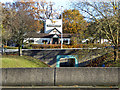
The Running Horse
Viewed across the Running Horse Roundabout on the A329.
Image: © Robin Webster
Taken: 17 Nov 2017
0.10 miles
4
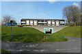
Subway and Cycleway
Bracknell's busy roads and too many roundabouts make driving here a tedious experience.
By contrast, the town's many cycleways make it easy to get around by bike.
This is in the middle of yet another roundabout, and you can zap through while all the cars are messing about up the top.
Image: © Des Blenkinsopp
Taken: 3 Apr 2017
0.11 miles
5
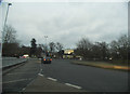
The Running Horse Roundabout, Bracknell
Image: © David Howard
Taken: 24 Feb 2013
0.11 miles
6
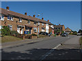
Calfridus Way, Bracknell
A typical early 1970s estate in the Harman's Water area of Bracknell.
Image: © Alan Hunt
Taken: 4 Sep 2013
0.12 miles
7
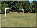
Goalposts, Allsmoor playing fields
A set of goalposts on the playing fields off Calfridus Way.
Image: © Alan Hunt
Taken: 4 Sep 2013
0.12 miles
8

Recreation area
The edge of the recreation area with a path up to Calfridus Way.
Image: © Alan Hunt
Taken: 4 Sep 2013
0.12 miles
9
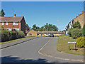
Calfridus Way, Bracknell
A short spur off Calfridus Way, a 1970s estate to the east of Bracknell.
Image: © Alan Hunt
Taken: 4 Sep 2013
0.12 miles
10
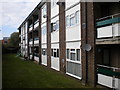
Low rise flats, Perry Oaks
The south facing wall of the block of low rise flats at the southern end of Perry Oaks, facing the roundabout where Broad Lane and Lily Hall Drive meet the A329 London Road.
Image: © Richard Vince
Taken: 16 Oct 2011
0.13 miles