
IMAGES TAKEN NEAR TO
Priory Walk, BRACKNELL, RG12 9JT
Introduction
This page details the photographs taken nearby to Priory Walk, RG12 9JT by members of the Geograph project.
The Geograph project started in 2005 with the aim of publishing, organising and preserving representative images for every square kilometre of Great Britain, Ireland and the Isle of Man.

There are currently over 7.5m images from over14,400 individuals and you can help contribute to the project by visiting https://www.geograph.org.uk
Image Map
Images are licensed for reuse under creativecommons.org/licenses/by-sa/2.0
Notes
- Clicking on the map will re-center to the selected point.
- The higher the marker number, the further away the image location is from the centre of the postcode.
Image Listing (23 Images Found)
Images are licensed for reuse under creativecommons.org/licenses/by-sa/2.0
Image
Details
Distance
1
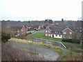
Martin's Heron, Bracknell
Looking southwest from the railway bridge. Strictly speaking, this is part of Winkfield not Bracknell.
Image: © Andrew Smith
Taken: 19 Feb 2006
0.09 miles
2
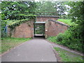
Bracknell: Pedestrian railway subway
Looking at old Ordnance Survey maps of the location it is evident that a public footpath existed here before the railway arrived in 1856, so the subway allowing pedestrians to pass from one side of the railway to the other is almost certainly part of the original fabric of the railway, rather than a modern bridge built to serve the needs of residents of the modern housing estates that have since sprung up on either side. Today it affords a connection between the Bullsbrook and Martin's Heron areas to the north of the railway with the Harmans Water area to the south.
Image: © Nigel Cox
Taken: 10 Jun 2010
0.10 miles
3
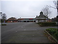
Tesco's Supermarket, Martin's Heron, Bracknell
Found to be quiet due to its not opening on Sundays.
Image: © Andrew Smith
Taken: 19 Feb 2006
0.11 miles
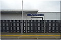
6
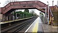
Martin's Heron Railway Station
Martin's Heron Railway Station on platform 1 looking under the footbridge
Image: © Shaun Ferguson
Taken: 5 Apr 2019
0.14 miles
8
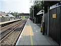
Martins Heron railway station, Berkshire
Opened in 1988 by British Rail on the line from Staines to Reading. View east towards Ascot and Staines.
Image: © Nigel Thompson
Taken: 28 Apr 2011
0.14 miles
9
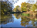
Allsmoor Pond
A kidney shaped pond - it bends round to the right - at one end of a recreation ground.
Image: © Robin Webster
Taken: 17 Nov 2017
0.15 miles
10
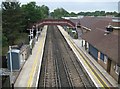
Martins Heron railway station
The station was built in 1988 as one of the conditions imposed by the local authority in allowing Tesco to build a superstore here, the back of the signboard of which can just be seen over the roofs to the right. This accounts for the Tesco house-style cupola on the station building to the right. This is a repeat of Andrew's Image from 2006 but just about the only change that is visible is the addition of anti-climb spikes to the CCTV posts.
The original London & South Western Railway line through here was completed in 1856.
I think the name should be pronounced Hern rather than Heron...
Image: © Nigel Cox
Taken: 10 Jun 2010
0.15 miles