
IMAGES TAKEN NEAR TO
Goldcrest Road, BRACKNELL, RG12 8DZ
Introduction
This page details the photographs taken nearby to Goldcrest Road, RG12 8DZ by members of the Geograph project.
The Geograph project started in 2005 with the aim of publishing, organising and preserving representative images for every square kilometre of Great Britain, Ireland and the Isle of Man.

There are currently over 7.5m images from over14,400 individuals and you can help contribute to the project by visiting https://www.geograph.org.uk
Image Map
Images are licensed for reuse under creativecommons.org/licenses/by-sa/2.0
Notes
- Clicking on the map will re-center to the selected point.
- The higher the marker number, the further away the image location is from the centre of the postcode.
Image Listing (26 Images Found)
Images are licensed for reuse under creativecommons.org/licenses/by-sa/2.0
Image
Details
Distance
1
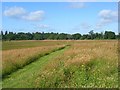
Grassland, Easthampstead
Looking along the line of the footpath near the edge of the Great Hollands estate. It crosses an large area of former farmland which has been out of production for some time.
Image: © Andrew Smith
Taken: 26 Jun 2008
0.04 miles
2
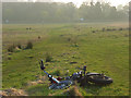
Grassland, Easthampstead Park
Abandoned scooter on the footpath descending from the northwest corner of the Great Hollands estate.
Image: © Andrew Smith
Taken: 3 Apr 2009
0.04 miles
3
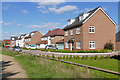
Kingfisher Close, Jennett's Park
New housing in the Jennett's Park development to the west of Bracknell.
Image: © Alan Hunt
Taken: 27 Sep 2015
0.09 miles
4
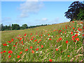
Grassland, Easthampstead
An attractive mix of wildflowers and long grass on uncultivated land just outside of built-up Bracknell.
Image: © Andrew Smith
Taken: 26 Jun 2008
0.11 miles
5
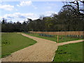
New path to Easthampstead Park
The footpath to Easthampstead Park has been diverted here and a new path completed with new landscaping.
Image: © don cload
Taken: 24 Mar 2009
0.11 miles
6
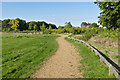
Path towards West Garden Copse
The path round the new recreation area to the west of Jennett's Park in Bracknell with West Garden Copse in the background.
Image: © Alan Hunt
Taken: 27 Sep 2015
0.13 miles
7
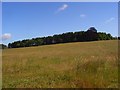
Grassland, Easthampstead
Looking up to an unmapped copse on the western side of the 82 metre hill.
Image: © Andrew Smith
Taken: 26 Jun 2008
0.13 miles
8
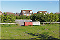
Car park, Jennett's Park
A large concrete block across the entrance to an overflow car park off Swift Fields in Jennett's Park. The car park serves the recreation area to the west of Jennett's Park housing estate.
Image: © Alan Hunt
Taken: 27 Sep 2015
0.14 miles
9
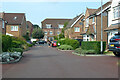
Bunting Lane, Jennett's Park, Bracknell
A maze-like development, fortunately with few dead-ends. The roads have a bird theme.
Image: © Robin Webster
Taken: 26 Sep 2021
0.15 miles
10
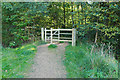
Footpath Gate, Easthampstead
The footpath gate from the Jennett's Park recreation area to the path that runs past Easthampstead College.
Image: © Alan Hunt
Taken: 27 Sep 2015
0.15 miles