
IMAGES TAKEN NEAR TO
Skimped Hill Lane, BRACKNELL, RG12 1BQ
Introduction
This page details the photographs taken nearby to Skimped Hill Lane, RG12 1BQ by members of the Geograph project.
The Geograph project started in 2005 with the aim of publishing, organising and preserving representative images for every square kilometre of Great Britain, Ireland and the Isle of Man.

There are currently over 7.5m images from over14,400 individuals and you can help contribute to the project by visiting https://www.geograph.org.uk
Image Map
Images are licensed for reuse under creativecommons.org/licenses/by-sa/2.0
Notes
- Clicking on the map will re-center to the selected point.
- The higher the marker number, the further away the image location is from the centre of the postcode.
Image Listing (56 Images Found)
Images are licensed for reuse under creativecommons.org/licenses/by-sa/2.0
Image
Details
Distance
1

Skimped Hill Lane, Bracknell
A quaint old name, but that's where the quaintness stops.
Image: © Des Blenkinsopp
Taken: 3 Apr 2017
0.02 miles
2

Fitzwilliam House, Bracknell
An L-shaped 1960s block (probably), with the characteristic disposition of a plain, higher service tower at the angle. Polished blue bands between the windows.
It is currently occupied by the local NHS trust.
Image: © Stephen Richards
Taken: 26 Jun 2011
0.02 miles
4

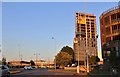
The Red Lion, Bracknell
The late 16th / early 17th century pub on High Street is now dwarfed by various office blocks near the town centre. It is one of 34 listed buildings within the new town of Bracknell. With one exception, these listed building are old ones that pre-date the establishment of the new town.
Image: © Andrew Smith
Taken: 1 Jul 2008
0.07 miles
5
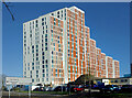
Large Building, Bracknell High Street
In a town centre where large buildings are all over the place, this one, with its distinctive shape and colours, is one you pay attention to.
Bracknell High Street is definitely a street of two halves. The east end is pedestrianized and lined with shops, while this end is all about cars and pedestrians are really not part of what's going on.
Image: © Des Blenkinsopp
Taken: 25 Nov 2022
0.07 miles
8
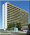
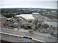
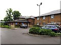
Winchester House, Bracknell
Quite a landmark in the town by virtue of its size and bright yellow spandrels. It was built in 1971. Since its previous occupants, 3M, left in 2003 it has lain empty, slowly rotting while conversion schemes have come and gone. Nothing definite is on the horizon at the time of writing.
Image: © Stephen Richards
Taken: 26 Jun 2011
0.09 miles

10

The Point, Cinema, Bowling & Pizza Hut
Despite this being taken a few months after the Cineworld opened only a few hundred yards away, the original multiplex for Bracknell still hangs on. It first opened in 1990, as UCI. Behind the camera is the Peel Centre retail park which boasts large store units. This was originally developed from 1988, including Safeway, now Morrisons, on a former residential area. However virtually all the units have since been upgraded.
Image: © Sam
Taken: 13 Nov 2017
0.09 miles