IMAGES TAKEN NEAR TO
Union Street, READING, RG1 1EU

Introduction

This page details the photographs taken nearby to Union Street, RG1 1EU by members of the Geograph project.

The Geograph project started in 2005 with the aim of publishing, organising and preserving representative images for every square kilometre of Great Britain, Ireland and the Isle of Man.

There are currently over 7.5m images from over14,400 individuals and you can help contribute to the project by visiting https://www.geograph.org.uk

Image Map


Images are licensed for reuse under creativecommons.org/licenses/by-sa/2.0
Notes
  • Clicking on the map will re-center to the selected point.
  • The higher the marker number, the further away the image location is from the centre of the postcode.

Image Listing (1566 Images Found)

Images are licensed for reuse under creativecommons.org/licenses/by-sa/2.0
  • ...
Image
Details
Distance
1
Buskers in Smelly Alley
Union Street was known as smelly alley due to the fishmongers. The date is approximate.
Image: © Roger A Smith Taken: Unknown
0.01 miles
2
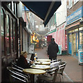
Foggy Reading ? north on Union Street
Union Street is an intimate shopping lane between Broad Street and Friar Street.
Image: © Robin Stott Taken: 11 Dec 2013
0.01 miles
3
Union Street, Reading
Colloquially known as Smelly Alley, this narrow pedestrianised street links Broad Street and Friar Street. It is home to mostly small, independent retailers, though you can also see the signage for two larger shops whose entrances are on Broad Street. The familiar name is a reference to the market traders selling meat, fish, fruit and vegetables.
Image: © Andrew Smith Taken: 16 Aug 2007
0.03 miles
4
Friar Street, Reading
A new Novotel hotel towers over Reading's brick architecture. The bus is just this side of the junction with Station Road, which goes off to the right. A branch of the Nationwide Building Society occupies the corner building behind the bus.
Image: © Andrew Smith Taken: 4 Oct 2007
0.03 miles
5
Friar Street, Reading
Looking west along Friar Street on a wet summer afternoon.
Image: © Oscar Taylor Taken: 4 Jul 2023
0.03 miles
6
The Bugle, Friar Street
A traditional looking pub which has managed to avoid redevelopment, it extends down a lane to the side called Fife Court. According to a local ex-soldiers' website ( http://www.farmersboys.com/News_Stories/old_comrades_royal_berks.htm ) the Bugle was opened by Simonds Brewery shortly after the Battle of Maiwand in 1880 (see Image ); the pub sign depicts a bugler of the 66th (Berkshire) Regiment.
Image: © Rose and Trev Clough Taken: 7 Feb 2008
0.03 miles
7
The Bugle, Friar Street, Reading
Image: © Robin Sones Taken: 9 Dec 2013
0.03 miles
8
The Bugle pub sign
The pub had closed down when this view was taken. See Image for some further background information.
Image: © Fernweh Taken: 28 Oct 2022
0.03 miles
9
Smelly Alley
Union Street, a narrow pedestrian street between Friar Street and Broad Street, is ubiquitously known in Reading as "Smelly Alley" because of all the fish and meat shops along here. Many are still there, just counters fronting the street, but these days there is a greater variety of shops. On the Saturday evening before Christmas all the stalls are closed.
Image: © Graham Horn Taken: 19 Dec 2009
0.03 miles
10
Looking down Fife Court
The boarded up premises are all part of The Bugle pub. See Image
Image: © Fernweh Taken: 28 Oct 2022
0.03 miles
  • ...