IMAGES TAKEN NEAR TO
Balmoral Close, SOUTHPORT, PR9 8QY
Introduction
This page details the photographs taken nearby to Balmoral Close, PR9 8QY by members of the Geograph project.
The Geograph project started in 2005 with the aim of publishing, organising and preserving representative images for every square kilometre of Great Britain, Ireland and the Isle of Man.

There are currently over 7.5m images from over14,400 individuals and you can help contribute to the project by visiting https://www.geograph.org.uk
Image Map (Loading...)


Getting Data...Please wait
Leaflet Map data © OpenStreetMap
Images are licensed for reuse under creativecommons.org/licenses/by-sa/2.0
Notes
- Clicking on the map will re-center to the selected point.
- The higher the marker number, the further away the image location is from the centre of the postcode.
Image Listing (10 Images Found)
Images are licensed for reuse under creativecommons.org/licenses/by-sa/2.0
Image
Details
Distance
2
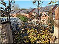
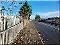
Site of former railway at Crossens
A somewhat obscured view of the course of the Southport to Crossens railway (closed 1964). The greenhouse stands this side of the line, the backs of houses on Balmoral Drive on the far side.
Image: © Oliver Dixon
Taken: 22 Oct 2024
0.13 miles
3
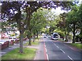
Looking across Verulam Road
Until comparatively recently, there was no way through on Verulam Road between Bankfield Lane and Balmoral Drive as the road was blocked off by the Southport to Crossens and Preston railway (closed 1964). On the far side of the road there is a narrow strip of unoccupied land on the course of the trackbed, sandwiched between the backs of the houses on Balmoral Drive (to the left) and Merlewood Avenue.
Image: © Oliver Dixon
Taken: 19 Oct 2024
0.16 miles
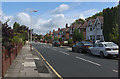
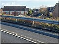
6
Old railway bridge on Bankfield Lane
The bridge crossed the Southport to Preston railway at this point, with Crossens station, the northern terminus of the electric service, where the houses on the right hand side of the road now stand.
Image: © Oliver Dixon
Taken: 22 Oct 2024
0.18 miles
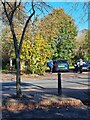
7
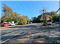
Verulam Road and Botanic Gardens car park
Until comparatively recently, there was no way through on Verulam Road between Bankfield Lane and Balmoral Drive as the road was blocked off by the Southport to Crossens and Preston railway (closed 1964). Not only has a way through been made, but the land released has been used to create a much-needed car park for the Botanic Gardens.
Image: © Oliver Dixon
Taken: 19 Oct 2024
0.19 miles
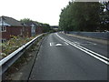
8
Crest of old railway bridge on Bankfield Lane
The bridge crossed the Southport to Preston railway at this point, with Crossens station, the northern terminus of the electric service, down to the left. The houses on the right hand side of the road were built on or adjacent to the site of the railway.
Image: © Oliver Dixon
Taken: 22 Oct 2024
0.19 miles
9
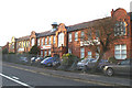
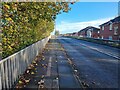
Difficult to miss
... judging by the state of the fence. I think this is the only Factory of this size and type in Southport.
Image: © David Long
Taken: 11 Jan 2006
0.21 miles
10
The Mallards
Seen across the Bankfield Lane bridge, a modern housing estate in the Mallards built on the site of the former Crossens station, terminus of the electric line from Southport. The line extended further to Preston for steam-operated services.
Image: © Oliver Dixon
Taken: 22 Oct 2024
0.23 miles