IMAGES TAKEN NEAR TO
Church Close, SOUTHPORT, PR9 8GR
Introduction
This page details the photographs taken nearby to Church Close, PR9 8GR by members of the Geograph project.
The Geograph project started in 2005 with the aim of publishing, organising and preserving representative images for every square kilometre of Great Britain, Ireland and the Isle of Man.

There are currently over 7.5m images from over14,400 individuals and you can help contribute to the project by visiting https://www.geograph.org.uk
Image Map (Loading...)


Getting Data...Please wait
Leaflet Map data © OpenStreetMap
Images are licensed for reuse under creativecommons.org/licenses/by-sa/2.0
Notes
- Clicking on the map will re-center to the selected point.
- The higher the marker number, the further away the image location is from the centre of the postcode.
Image Listing (34 Images Found)
Images are licensed for reuse under creativecommons.org/licenses/by-sa/2.0
Image
Details
Distance
1
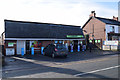
Cooperative Food store, Banks
On Church Road
Image: © Keith Edkins
Taken: 9 Mar 2018
0.04 miles
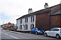
3
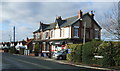
Mackay's Newsagents
The post box is PR9 143: it used to be outside the post office 250m west of here, but moved in about 2013 when the post office closed.
Image: © Keith Edkins
Taken: 9 Mar 2018
0.09 miles
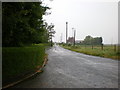
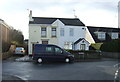
4
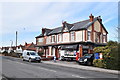
New development off Charnley's Lane
Image: © Alexander P Kapp
Taken: 17 Jun 2009
0.10 miles
10
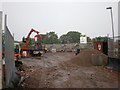
Fleetwood Farm
It has a stone giving a date of 1787
Image: © Keith Edkins
Taken: 9 Mar 2018
0.15 miles