IMAGES TAKEN NEAR TO
Mere Lane, SOUTHPORT, PR9 8DA
Introduction
This page details the photographs taken nearby to Mere Lane, PR9 8DA by members of the Geograph project.
The Geograph project started in 2005 with the aim of publishing, organising and preserving representative images for every square kilometre of Great Britain, Ireland and the Isle of Man.

There are currently over 7.5m images from over14,400 individuals and you can help contribute to the project by visiting https://www.geograph.org.uk
Image Map (Loading...)


Getting Data...Please wait
Leaflet Map data © OpenStreetMap
Images are licensed for reuse under creativecommons.org/licenses/by-sa/2.0
Notes
- Clicking on the map will re-center to the selected point.
- The higher the marker number, the further away the image location is from the centre of the postcode.
Image Listing (11 Images Found)
Images are licensed for reuse under creativecommons.org/licenses/by-sa/2.0
Image
Details
Distance
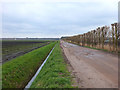
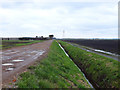
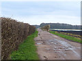
2
Mere Lane
The lane is surrounded by farmland, and heads to farm buildings and nurseries.
Image: © Bradley Michael
Taken: 28 Aug 2015
0.08 miles
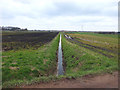
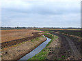
3
Mere Lane
Between Larkfield Nurseries and Ring Ditch
Image: © Gary Rogers
Taken: 8 Apr 2018
0.11 miles
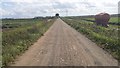
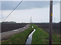
4
Mere Lane approaching Larkfield Nurseries
Image: © Gary Rogers
Taken: 8 Apr 2018
0.11 miles
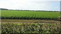
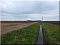
9
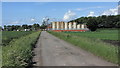
Mere Lane, Banks
In the picture are the storage tanks of an fuel oil distribution company
Image: © K A
Taken: 17 Jun 2012
0.24 miles