IMAGES TAKEN NEAR TO
Knowsley Road, SOUTHPORT, PR9 0HW
Introduction
This page details the photographs taken nearby to Knowsley Road, PR9 0HW by members of the Geograph project.
The Geograph project started in 2005 with the aim of publishing, organising and preserving representative images for every square kilometre of Great Britain, Ireland and the Isle of Man.

There are currently over 7.5m images from over14,400 individuals and you can help contribute to the project by visiting https://www.geograph.org.uk
Image Map
Images are licensed for reuse under creativecommons.org/licenses/by-sa/2.0
Notes
- Clicking on the map will re-center to the selected point.
- The higher the marker number, the further away the image location is from the centre of the postcode.
Image Listing (29 Images Found)
Images are licensed for reuse under creativecommons.org/licenses/by-sa/2.0
Image
Details
Distance
1
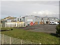
Southport revisited - Southport Golf Links
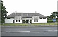
Back in the 1950s, there was a bar on Jewish members at all five private Golf Clubs within the Southport Borough boundary. I was appalled at this blatant example of prejudice and discrimination, and fired up with youthful idealism, told my parents so. Nevertheless it didn't stop them joining one of said clubs. The only place in town where members of the sizeable Jewish community could play golf was at the Municipal Links which were, by a stroke of good fortune, both one of the oldest and finest municipal courses in the country. I am happy to say that this appalling discrimination is no longer tolerated.
I could be wrong but it looks to me as if the building which houses the administration of the course is no longer occupied. The Park Club, a members club which plays on the Municipal Course has a clubhouse next door.
Image: © Oliver Dixon
Taken: 11 Aug 2021
0.05 miles
2
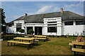
Turf zone SouthportGolf
White House Brasserie, Southport Golf Club.
Image: © Ian S
Taken: 16 Jun 2023
0.06 miles
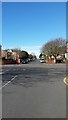
3
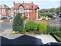
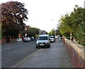
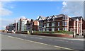
Avondale Road North
At the junction with Leyland Road.
Image: © Gerald England
Taken: 15 May 2022
0.07 miles
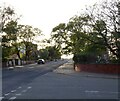
6
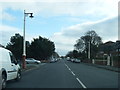
Leyland Road, Southport
A tree-lined avenue heading to the seashore.
Image: © Peter Mackenzie
Taken: 16 Mar 2017
0.16 miles
8
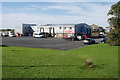
Lakeside Church
An Elim Pentecostal Church on the edge of Marine Lake. It moved to this site in 2010.
Image: © Bill Boaden
Taken: 14 Sep 2019
0.18 miles
10
Lakeside Church, Southport
A church building on the edge of Marine Lake, part of the Elim Pentecostal Church.
Image: © Graham Robson
Taken: 24 Mar 2018
0.18 miles