IMAGES TAKEN NEAR TO
Cheltenham Way, SOUTHPORT, PR8 5NR
Introduction
This page details the photographs taken nearby to Cheltenham Way, PR8 5NR by members of the Geograph project.
The Geograph project started in 2005 with the aim of publishing, organising and preserving representative images for every square kilometre of Great Britain, Ireland and the Isle of Man.

There are currently over 7.5m images from over14,400 individuals and you can help contribute to the project by visiting https://www.geograph.org.uk
Image Map (Loading...)


Getting Data...Please wait
Leaflet Map data © OpenStreetMap
Images are licensed for reuse under creativecommons.org/licenses/by-sa/2.0
Notes
- Clicking on the map will re-center to the selected point.
- The higher the marker number, the further away the image location is from the centre of the postcode.
Image Listing (8 Images Found)
Images are licensed for reuse under creativecommons.org/licenses/by-sa/2.0
Image
Details
Distance
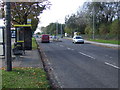
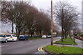
4
Town Lane passes the Hospital Entrance
Image: © Anthony Parkes
Taken: 15 Feb 2013
0.14 miles

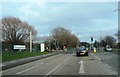
7
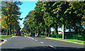
Scarisbrick New Road (A570), Southport
Scarisbrick New Road, passing Meols Park.
Image: © David Dixon
Taken: 25 Sep 2010
0.18 miles
8
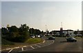
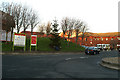
Meols Cop Roundabout
Just off the Meols Cop Roundabout on the A570 is the Tesco supermarket.
Image: © Gerald England
Taken: 26 Sep 2008
0.23 miles