IMAGES TAKEN NEAR TO
Woodvale Road, SOUTHPORT, PR8 3SU
Introduction
This page details the photographs taken nearby to Woodvale Road, PR8 3SU by members of the Geograph project.
The Geograph project started in 2005 with the aim of publishing, organising and preserving representative images for every square kilometre of Great Britain, Ireland and the Isle of Man.

There are currently over 7.5m images from over14,400 individuals and you can help contribute to the project by visiting https://www.geograph.org.uk
Image Map
Images are licensed for reuse under creativecommons.org/licenses/by-sa/2.0
Notes
- Clicking on the map will re-center to the selected point.
- The higher the marker number, the further away the image location is from the centre of the postcode.
Image Listing (11 Images Found)
Images are licensed for reuse under creativecommons.org/licenses/by-sa/2.0
Image
Details
Distance
3
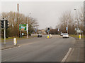
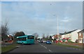
Southport Old Road diverges from the Formby Bypass
Image: © Raymond Knapman
Taken: 8 Aug 2012
0.20 miles
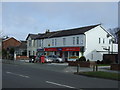
4
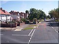
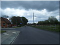
Liverpool Road at Woodvale
Meadow Lane joins on left of view
Image: © Raymond Knapman
Taken: 8 Aug 2012
0.20 miles
5
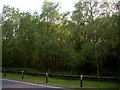
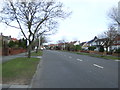
Birch trees along Coastal Road, Woodvale
Image: © Tom Pennington
Taken: 11 May 2008
0.21 miles
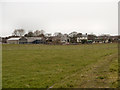
6
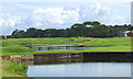
Looking North from the third tee
An empty level field has been transformed by this spectacular development.
Image: © stan lewis
Taken: 13 Aug 2008
0.21 miles
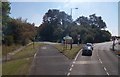
10
Headbolt Farm
Looking towards headbolt Farm from Plex Moss Lane.
Image: © David Dixon
Taken: 23 Feb 2013
0.23 miles