IMAGES TAKEN NEAR TO
The Paddock, SOUTHPORT, PR8 3PT
Introduction
This page details the photographs taken nearby to The Paddock, PR8 3PT by members of the Geograph project.
The Geograph project started in 2005 with the aim of publishing, organising and preserving representative images for every square kilometre of Great Britain, Ireland and the Isle of Man.

There are currently over 7.5m images from over14,400 individuals and you can help contribute to the project by visiting https://www.geograph.org.uk
Image Map (Loading...)


Getting Data...Please wait
Leaflet Map data © OpenStreetMap
Images are licensed for reuse under creativecommons.org/licenses/by-sa/2.0
Notes
- Clicking on the map will re-center to the selected point.
- The higher the marker number, the further away the image location is from the centre of the postcode.
Image Listing (5 Images Found)
Images are licensed for reuse under creativecommons.org/licenses/by-sa/2.0
Image
Details
Distance
1
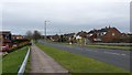
Kenilworth Road, Ainsdale
Kenilworth Road is shown descending from the railway crossing.
Image: © Peter Mackenzie
Taken: 16 Mar 2017
0.09 miles
2
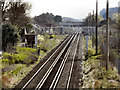
Railway at Ainsdale
Looking south-west, from the bridge at Kenilworth Road.
Image: © David Dixon
Taken: 9 Apr 2011
0.16 miles
3
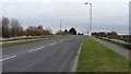
Kenilworth Road Bridge
Kenilworth Road, crossing the railway to the south of Ainsdale Station.
Image: © David Dixon
Taken: 9 Apr 2011
0.16 miles
4

Railway at Ainsdale
Looking along the railway towards Ainsdale Station, from the bridge at Kenilworth Road.
Image: © David Dixon
Taken: 9 Apr 2011
0.19 miles
5
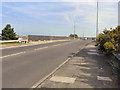
Road over the railway in Ainsdale
The picture shows a modern road re-alignment to cross over the railway.
Image: © Peter Mackenzie
Taken: 16 Mar 2017
0.20 miles