
IMAGES TAKEN NEAR TO
Stratford Close, SOUTHPORT, PR8 2RT
Introduction
This page details the photographs taken nearby to Stratford Close, PR8 2RT by members of the Geograph project.
The Geograph project started in 2005 with the aim of publishing, organising and preserving representative images for every square kilometre of Great Britain, Ireland and the Isle of Man.

There are currently over 7.5m images from over14,400 individuals and you can help contribute to the project by visiting https://www.geograph.org.uk
Image Map
Images are licensed for reuse under creativecommons.org/licenses/by-sa/2.0
Notes
- Clicking on the map will re-center to the selected point.
- The higher the marker number, the further away the image location is from the centre of the postcode.
Image Listing (42 Images Found)
Images are licensed for reuse under creativecommons.org/licenses/by-sa/2.0
Image
Details
Distance
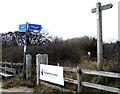
2
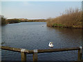
Ainsdale Nature Reserve
There's lots to photograph in this square. This is the lake in the northwest corner. A boardwalk path runs all the way round.
Image: © Gary Rogers
Taken: 25 Apr 2005
0.11 miles
3
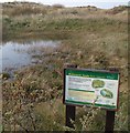
Natterjack Toads live here!
A dune slack in Ainsdale Nature Reserve
Image: © Gary Rogers
Taken: 25 Apr 2005
0.11 miles
4
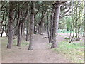
Path through Pines
Between the Coastal Road and Barford Close
Image: © Gary Rogers
Taken: 16 Mar 2016
0.11 miles
5
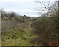
Path between Sefton Coast Path and Grafton Close
Image: © Gary Rogers
Taken: 16 Mar 2016
0.11 miles
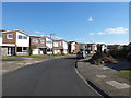
7
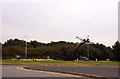
Roundabout at Ainsdale
A replica of a Lockheed Electra has been put on the roundabout.
Image: © Steve Daniels
Taken: 13 Oct 2010
0.13 miles
8
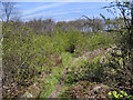
Sefton Coastal Path
The Sefton Coastal Path winding through low woodland and sandhills as it passes parallel to Coastal Road, just to the north of Shore Road at Ainsdale.
http://www.merseytravel.gov.uk/articleimages/SEFTONS%20NATURAL%20COAST.pdf
This was the course of the former Cheshire Lines (CLC) railway from Liverpool (Central), via Gateacre and Aintree to Southport (Lord Street), closed beyond Aintree back in 1952.
Image: © David Dixon
Taken: 9 Apr 2011
0.14 miles
9
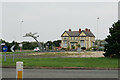
Sands Roundabout
The aircraft sculpture in the middle of the roundabout commemorates a transatlantic flight in 1937 which took off from nearby Ainsdale Beach.
Image: © Bill Boaden
Taken: 18 Sep 2021
0.14 miles
10
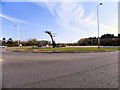
Shore Road Roundabout
The traffic island at the junction of Coastal Road with Shore Road, Ainsdale.
Image: © David Dixon
Taken: 9 Apr 2011
0.14 miles