IMAGES TAKEN NEAR TO
Trethorne Avenue, CHORLEY, PR7 7GY
Introduction
This page details the photographs taken nearby to Trethorne Avenue, PR7 7GY by members of the Geograph project.
The Geograph project started in 2005 with the aim of publishing, organising and preserving representative images for every square kilometre of Great Britain, Ireland and the Isle of Man.

There are currently over 7.5m images from over14,400 individuals and you can help contribute to the project by visiting https://www.geograph.org.uk
Image Map
Images are licensed for reuse under creativecommons.org/licenses/by-sa/2.0
Notes
- Clicking on the map will re-center to the selected point.
- The higher the marker number, the further away the image location is from the centre of the postcode.
Image Listing (6 Images Found)
Images are licensed for reuse under creativecommons.org/licenses/by-sa/2.0
Image
Details
Distance
1
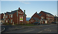
Bracken Ghyll Close - Buckshaw Village
Image: © Anthony Parkes
Taken: 20 Oct 2017
0.09 miles
2
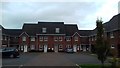
Euxton Fold - A new housing development for Persimmon Homes
Image: © Ian Greig
Taken: 12 Jan 2013
0.10 miles
5
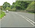
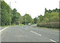
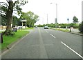
![50 mile speed limit, Wigan Road [A49]](https://s1.geograph.org.uk/geophotos/02/00/92/2009297_78475a3c_120x120.jpg)
50 mile speed limit, Wigan Road [A49]
The sign on the left marks the entrance to the pet cemetery.
Image: © Ann Cook
Taken: 11 Aug 2010
0.16 miles