
IMAGES TAKEN NEAR TO
Park Avenue, CHORLEY, PR7 6JQ
Introduction
This page details the photographs taken nearby to Park Avenue, PR7 6JQ by members of the Geograph project.
The Geograph project started in 2005 with the aim of publishing, organising and preserving representative images for every square kilometre of Great Britain, Ireland and the Isle of Man.

There are currently over 7.5m images from over14,400 individuals and you can help contribute to the project by visiting https://www.geograph.org.uk
Image Map
Images are licensed for reuse under creativecommons.org/licenses/by-sa/2.0
Notes
- Clicking on the map will re-center to the selected point.
- The higher the marker number, the further away the image location is from the centre of the postcode.
Image Listing (30 Images Found)
Images are licensed for reuse under creativecommons.org/licenses/by-sa/2.0
Image
Details
Distance
1
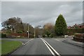
![Wigan Road, Euxton [A49] approaching a roundabout](https://s0.geograph.org.uk/geophotos/02/03/85/2038536_20b51200_120x120.jpg)
Wigan Road, Euxton [A49] approaching a roundabout
Image: © Ann Cook
Taken: 29 Aug 2010
0.05 miles
3
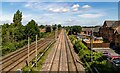
West Coast Main Line
WCML at Euxton.
Image: © Peter McDermott
Taken: 7 Jul 2023
0.09 miles
4
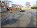
Skatepark, Balshaw Lane, Euxton
Very poor compared to others in the region
Image: © Gary Rogers
Taken: 19 Mar 2015
0.09 miles
6
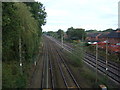
Railway heading north from Euxton Railway Station
Loop line from the station rejoins the main line towards Preston.
Image: © JThomas
Taken: 11 Oct 2014
0.10 miles
7
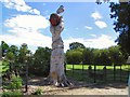
Apple Tree
This imaginative sculpture, carved from the trunk of a dead tree, is at Euxton Hall Hospital
Image: © Roger May
Taken: 8 Aug 2005
0.11 miles
9
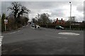
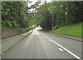
Balshaw Lane
Balshaw Lane towards Euxton Station from Wigan Rd
Image: © Galatas
Taken: 5 Feb 2008
0.12 miles
10
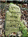
LEPCO Danger High Pressure Cable
Old marker stone by the A49 at Euxton
Image: © Gary Rogers
Taken: 19 Mar 2015
0.12 miles