IMAGES TAKEN NEAR TO
Greenside, CHORLEY, PR7 6AS
Introduction
This page details the photographs taken nearby to Greenside, PR7 6AS by members of the Geograph project.
The Geograph project started in 2005 with the aim of publishing, organising and preserving representative images for every square kilometre of Great Britain, Ireland and the Isle of Man.

There are currently over 7.5m images from over14,400 individuals and you can help contribute to the project by visiting https://www.geograph.org.uk
Image Map
Images are licensed for reuse under creativecommons.org/licenses/by-sa/2.0
Notes
- Clicking on the map will re-center to the selected point.
- The higher the marker number, the further away the image location is from the centre of the postcode.
Image Listing (46 Images Found)
Images are licensed for reuse under creativecommons.org/licenses/by-sa/2.0
Image
Details
Distance
1
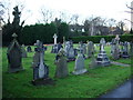
St Mary's Catholic Church, Euxton, Graveyard
Image: © Alexander P Kapp
Taken: 9 Dec 2007
0.10 miles
4
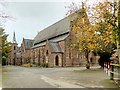
Roman Catholic Church of St Mary, Euxton
A grade II listed building dating from 1864-5 (English Heritage Building ID: 357644 http://www.britishlistedbuildings.co.uk/en-357644-roman-catholic-church-of-st-mary-euxton- British Listed Buildings). The building to the rear, with the clock tower and spire, is the presbytery.
http://www.stmarys-euxton.com/church.html Church website
Image: © David Dixon
Taken: 16 Nov 2014
0.12 miles
5
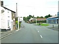
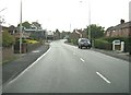
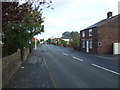
Wigan Road, Euxton
Euxton Tile Supplies is on the right.
Image: © Ann Cook
Taken: 29 Aug 2010
0.12 miles
6
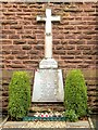
War Memorial Cross at St Mary's Church
The War memorial Cross at Image] was erected in the church grounds following the First World War to commemorate the 9 parishioners who gave their lives in that conflict. An extension to the Memorial was added after World War II to further commemorate the 7 parishioners who gave their lives in that conflict. The Memorial remained free-standing in the church grounds until the Cross was damaged by vandals. Following the vandalism, the Memorial was re-set and built into the wall of the porch; it was re-dedicated on 3rd November 1996 (http://www.stmarys-euxton.com/history.html St Mary's Parish History).
The inscription above the names reads:
"In Paradisum deducant te Angeli"(which translates as "May the Angels lead you to Paradise")
1914-18
Image: © David Dixon
Taken: 16 Nov 2014
0.12 miles
7
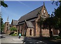
Church and Presbytery, Euxton
St. Mary's R.C. church. The building to the rear, with the clock tower, is the presbytery. The Grade 2 listed building was opened in 1865.
Image: © philandju
Taken: 21 May 2012
0.12 miles
8
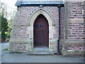
St Mary's Catholic Church, Euxton, Doorway
Image: © Alexander P Kapp
Taken: 9 Dec 2007
0.12 miles
9

War Memorial St Mary's Catholic Church, Euxton
Image: © Alexander P Kapp
Taken: 9 Dec 2007
0.12 miles