
IMAGES TAKEN NEAR TO
Pilgrim Drive, CHORLEY, PR7 3TH
Introduction
This page details the photographs taken nearby to Pilgrim Drive, PR7 3TH by members of the Geograph project.
The Geograph project started in 2005 with the aim of publishing, organising and preserving representative images for every square kilometre of Great Britain, Ireland and the Isle of Man.

There are currently over 7.5m images from over14,400 individuals and you can help contribute to the project by visiting https://www.geograph.org.uk
Image Map
Images are licensed for reuse under creativecommons.org/licenses/by-sa/2.0
Notes
- Clicking on the map will re-center to the selected point.
- The higher the marker number, the further away the image location is from the centre of the postcode.
Image Listing (6 Images Found)
Images are licensed for reuse under creativecommons.org/licenses/by-sa/2.0
Image
Details
Distance
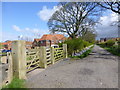
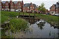
3
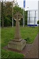
Stone Cross at Mayflower Gardens, Eaves Green
Image: © Ian S
Taken: 22 May 2015
0.11 miles
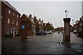
5
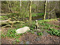
Much loved dog's grave in John Wood
River Yarrow in background
Image: © Raymond Knapman
Taken: 14 Apr 2014
0.15 miles
6
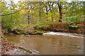
River Yarrow
In the Yarrow Valley near Dexbury Park golf course. This fallen trunk has created a narrow channel causing turbulence and white water. The river was flowing very quickly after recent heavy rain. Some of the trees in the woodland on the western bank of the Yarrow are very tall.
Image: © Gary Rogers
Taken: 26 Oct 2008
0.22 miles