
IMAGES TAKEN NEAR TO
Carr Lane, CHORLEY, PR7 3JX
Introduction
This page details the photographs taken nearby to Carr Lane, PR7 3JX by members of the Geograph project.
The Geograph project started in 2005 with the aim of publishing, organising and preserving representative images for every square kilometre of Great Britain, Ireland and the Isle of Man.

There are currently over 7.5m images from over14,400 individuals and you can help contribute to the project by visiting https://www.geograph.org.uk
Image Map
Images are licensed for reuse under creativecommons.org/licenses/by-sa/2.0
Notes
- Clicking on the map will re-center to the selected point.
- The higher the marker number, the further away the image location is from the centre of the postcode.
Image Listing (34 Images Found)
Images are licensed for reuse under creativecommons.org/licenses/by-sa/2.0
Image
Details
Distance
2

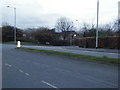
Old Boundary Marker by the A6, Bolton Road, Chorley
Parish Boundary Marker standing well back on the verge on the west side of the A6 Bolton Road, Chorley, opposite Hogg's Lane. On the former boundary of Duxbury and Chorley parishes. In 1934 Duxbury parish was split between Coppull, Heath Charnock and Chorley parishes and from then the stone was entirely in Chorley parish. The stone was first marked on old Ordnance Survey maps in 1930 on the east side of Bolton Road, which was the wrong side for the current inscriptions, although we have previously noted that the parish names appeared to have been erased. It was first surveyed by the Milestone Society at SD5916716261 on the east side of Bolton Road behind railings in the school playing field a little north of the junction with Hogg's Lane. It was moved to the west side sometime between May 2009 and April 2015 and the parish names have been recut. See also https://www.geograph.org.uk/photo/6068659.
Milestone Society National ID: LA_BOCY09pb
Image: © C Leather
Taken: 13 Nov 2024
0.04 miles
3

Old Boundary Marker by the A6, Bolton Road, Chorley
Parish Boundary Marker standing well back on the verge on the west side of the A6 Bolton Road, Chorley, opposite Hogg's Lane. On the former boundary of Duxbury and Chorley parishes. In 1934 Duxbury parish was split between Coppull, Heath Charnock and Chorley parishes and from then the stone was entirely in Chorley parish. The stone was first marked on old Ordnance Survey maps in 1930 on the east side of Bolton Road, which was the wrong side for the current inscriptions, although we have previously noted that the parish names appeared to have been erased. It was first surveyed by the Milestone Society at SD5916716261 on the east side of Bolton Road behind railings in the school playing field a little north of the junction with Hogg's Lane. It was moved to the west side sometime between May 2009 and April 2015 and the parish names have been recut. See https://www.geograph.org.uk/photo/7949401 for a more recent photo.
Milestone Society National ID: LA_BOCY09pb
Image: © Milestone Society
Taken: 1 May 2013
0.04 miles
4
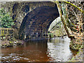
River Yarrow, Yarrow Bridge
The bridge taking the A6 (Bolton Road) over the River Yarrow.
Image: © David Dixon
Taken: 30 Jan 2012
0.06 miles
5
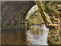
River Yarrow
The River Yarrow at Yarrow Bridge.
Image: © David Dixon
Taken: 30 Jan 2012
0.06 miles
7
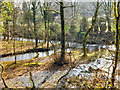
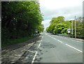
Black Brook and River Yarrow
The confluence of Black Brook with the River Yarrow.
Image: © David Dixon
Taken: 30 Jan 2012
0.07 miles
8
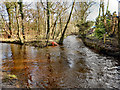
Waters Meeting
The confluence of the River Yarrow (on the right) and Black Brook (on the left).
Image: © David Dixon
Taken: 30 Jan 2012
0.08 miles
9

Bridge on Hogg's Lane
The bridge over Black Brook.
Image: © David Dixon
Taken: 30 Jan 2012
0.08 miles
10

Hogg's Lane Bridge
Hogg's Lane crossing over Black Brook
Image: © David Dixon
Taken: 30 Jan 2012
0.09 miles