IMAGES TAKEN NEAR TO
Rangletts Avenue, CHORLEY, PR7 3HT
Introduction
This page details the photographs taken nearby to Rangletts Avenue, PR7 3HT by members of the Geograph project.
The Geograph project started in 2005 with the aim of publishing, organising and preserving representative images for every square kilometre of Great Britain, Ireland and the Isle of Man.

There are currently over 7.5m images from over14,400 individuals and you can help contribute to the project by visiting https://www.geograph.org.uk
Image Map
Images are licensed for reuse under creativecommons.org/licenses/by-sa/2.0
Notes
- Clicking on the map will re-center to the selected point.
- The higher the marker number, the further away the image location is from the centre of the postcode.
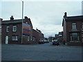
Image Listing (16 Images Found)
Images are licensed for reuse under creativecommons.org/licenses/by-sa/2.0
Image
Details
Distance
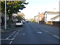
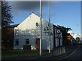
4
Pall Mall, Chorley Moor (B5251)
Heading north east.
Image: © JThomas
Taken: 11 Oct 2014
0.17 miles

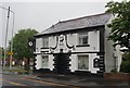
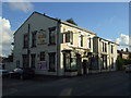
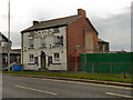
9
Black Horse, 252 Pall Mall, Chorley
Image: © Alexander P Kapp
Taken: 2 Jan 2009
0.24 miles
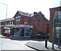
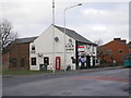
10
Eagle Hotel
Public house on Bolton Street, Chorley
Image: © David Dixon
Taken: 30 Jan 2012
0.24 miles