
IMAGES TAKEN NEAR TO
West Street, CHORLEY, PR7 2SJ
Introduction
This page details the photographs taken nearby to West Street, PR7 2SJ by members of the Geograph project.
The Geograph project started in 2005 with the aim of publishing, organising and preserving representative images for every square kilometre of Great Britain, Ireland and the Isle of Man.

There are currently over 7.5m images from over14,400 individuals and you can help contribute to the project by visiting https://www.geograph.org.uk
Image Map
Images are licensed for reuse under creativecommons.org/licenses/by-sa/2.0
Notes
- Clicking on the map will re-center to the selected point.
- The higher the marker number, the further away the image location is from the centre of the postcode.
Image Listing (255 Images Found)
Images are licensed for reuse under creativecommons.org/licenses/by-sa/2.0
Image
Details
Distance
1

Steps leading to Market Street
This view is from West Street car park.
Image: © Ann Cook
Taken: 29 Aug 2012
0.02 miles
2

Market Street looking towards the Town Hall
Image: © Ann Cook
Taken: 11 Aug 2010
0.03 miles
3

Blessed are the geographically challenged
Roger Wrenno (aka Wrenall) was a Chorley weaver who was imprisoned in Lancaster gaol for assisting priests. He escaped one night with a fellow prisoner (a priest from Whalley) but was captured the following morning near the gaol after apparently walking around in circles all night. The pair were both hanged shortly afterwards. Had Roger been proficient with map and compass he might never have become a Catholic martyr. This plaque is on a wall on Market Street near St Mary's Catholic church.
Image: © michael ely
Taken: 8 Jan 2009
0.03 miles
4

St. Mary's RC Church
The walkway passing the church is a cut through to West Street car park.
Image: © Ann Cook
Taken: 29 Aug 2012
0.03 miles
5

The tower of St Mary's R.C. church
The walkway between Market Street and Peter Street with the tower of St Mary's in the background. http://www.stmarys-chorley.org/index.html
Image: © John S Turner
Taken: 28 Apr 2011
0.03 miles
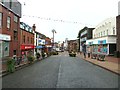

8

St Mary's Catholic Church, Chorley
In 1851 The Roman Catholic church purchased the Mount Pleasant estate from the Catholic Harrison family for the purpose of building a new church and school. The Mount Pleasant name is believed to have come about because of the views to the eastern hills from here. The building was designed by Joseph A. (or John - sources differ) Hansom (of 'Hansom cab' fame), with the tower added in 1894. It is now grade II listed.
Image: © Stephen McKay
Taken: 5 Jun 2023
0.03 miles
9
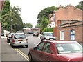
West Street
Devonshire Road car park can be seen at the end of the street.
Image: © Ann Cook
Taken: 11 Aug 2010
0.03 miles
10

The porch to St Mary's R.C. church
This porch is at the southwest corner of the church in Mount Pleasant. http://www.stmarys-chorley.org/index.html
Image: © John S Turner
Taken: 28 Apr 2011
0.04 miles