
IMAGES TAKEN NEAR TO
St. Marys Walk, CHORLEY, PR7 2RT
Introduction
This page details the photographs taken nearby to St. Marys Walk, PR7 2RT by members of the Geograph project.
The Geograph project started in 2005 with the aim of publishing, organising and preserving representative images for every square kilometre of Great Britain, Ireland and the Isle of Man.

There are currently over 7.5m images from over14,400 individuals and you can help contribute to the project by visiting https://www.geograph.org.uk
Image Map
Images are licensed for reuse under creativecommons.org/licenses/by-sa/2.0
Notes
- Clicking on the map will re-center to the selected point.
- The higher the marker number, the further away the image location is from the centre of the postcode.
Image Listing (262 Images Found)
Images are licensed for reuse under creativecommons.org/licenses/by-sa/2.0
Image
Details
Distance
1
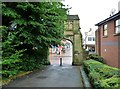
St Mary's Church gateway
Beyond the gateway are Market Street and Chapel Street.
Image: © Ann Cook
Taken: 29 Aug 2012
0.01 miles
2
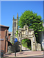
The arch over the walkway to St Mary's R.C. church
Looking across Market Street towards the 1912 Grade II listed archway to St Mary's church. Above the opening there is an inscription in Gothic script that reads:
"O all ye that pass by the way attend and see if there be any sorrow like to my sorrow"
Lamentations 1:12 Douay-Rheims Bible
Image: © John S Turner
Taken: 28 Apr 2011
0.01 miles
3
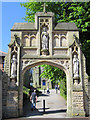
The arch over the walkway to St Mary's R.C. church #2
This 1912 Grade II listed archway to St Mary's church is in Market Street. Above the opening there is an inscription in Gothic script that reads:
"O all ye that pass by the way attend and see if there be any sorrow like to my sorrow"
Lamentations 1:12 Douay-Rheims Bible
Image: © John S Turner
Taken: 28 Apr 2011
0.01 miles
4

St. Mary's RC Church
The walkway passing the church is a cut through to West Street car park.
Image: © Ann Cook
Taken: 29 Aug 2012
0.01 miles
5

Entrance to St. Mary's church grounds
This beautifully carved arch stands on Market Street. The path through the arch passes the church and is used as a short cut to the car park on Devonshire Road.
Image: © Ann Cook
Taken: 11 Aug 2010
0.01 miles
6

Market Street looking from Chapel Street
The entrance to St. Mary's church is bounded on each side by a bank. This area is traffic free.
Image: © Ann Cook
Taken: 11 Aug 2010
0.01 miles
7

The tower of St Mary's R.C. church
The walkway between Market Street and Peter Street with the tower of St Mary's in the background. http://www.stmarys-chorley.org/index.html
Image: © John S Turner
Taken: 28 Apr 2011
0.02 miles
9

St Mary's Catholic Church, Chorley
In 1851 The Roman Catholic church purchased the Mount Pleasant estate from the Catholic Harrison family for the purpose of building a new church and school. The Mount Pleasant name is believed to have come about because of the views to the eastern hills from here. The building was designed by Joseph A. (or John - sources differ) Hansom (of 'Hansom cab' fame), with the tower added in 1894. It is now grade II listed.
Image: © Stephen McKay
Taken: 5 Jun 2023
0.02 miles
10

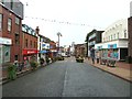
Market Street looking towards the Town Hall
Image: © Ann Cook
Taken: 11 Aug 2010
0.03 miles