IMAGES TAKEN NEAR TO
Park Road, CHORLEY, PR7 1QN
Introduction
This page details the photographs taken nearby to Park Road, PR7 1QN by members of the Geograph project.
The Geograph project started in 2005 with the aim of publishing, organising and preserving representative images for every square kilometre of Great Britain, Ireland and the Isle of Man.

There are currently over 7.5m images from over14,400 individuals and you can help contribute to the project by visiting https://www.geograph.org.uk
Image Map
Images are licensed for reuse under creativecommons.org/licenses/by-sa/2.0
Notes
- Clicking on the map will re-center to the selected point.
- The higher the marker number, the further away the image location is from the centre of the postcode.
Image Listing (132 Images Found)
Images are licensed for reuse under creativecommons.org/licenses/by-sa/2.0
Image
Details
Distance
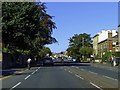

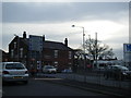
3
Park Road, Chorley (A581)
Heading north east, bus stop on the left.
Image: © JThomas
Taken: 22 Nov 2014
0.07 miles
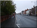
7
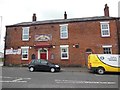
Trader Jacks, Chorley
http://www.geograph.org.uk/photo/4492439
Image: © Ian S
Taken: 25 May 2015
0.14 miles
8

Trader Jacks, Chorley
http://www.geograph.org.uk/photo/4492431
Image: © Ian S
Taken: 25 May 2015
0.14 miles
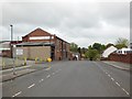
9
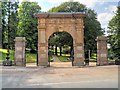
War Memorial Gateway to Astley Park, Chorley
The War Memorial Gateway Arch was erected at the Park Road entrance to Astley Park around 1923. Probably of nineteenth century origin, it had previously marked the entrance to the Gillibrand Estate and was moved to this location as a war memorial. The frieze now lettered:
PRO PATRIA
1914-1918
It was officially opened and dedicated at a civic ceremony on 31st May 1924.
The Memorial Arch is a grade II listed building (English Heritage Building ID: 357575 http://www.britishlistedbuildings.co.uk/en-357575-war-memorial-gateway-to-astley-park-lanc British Listed Buildings)
Image: © David Dixon
Taken: 11 Jun 2014
0.14 miles
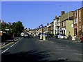
10
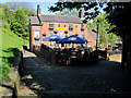
The Swan With Two Necks
'The Swan With Two Necks' is at the end of Hollinshead Street below Church Brow. It is Grade II listed.
Image: © John S Turner
Taken: 28 Apr 2011
0.14 miles