IMAGES TAKEN NEAR TO
Union Street, CHORLEY, PR7 1EB
Introduction
This page details the photographs taken nearby to Union Street, PR7 1EB by members of the Geograph project.
The Geograph project started in 2005 with the aim of publishing, organising and preserving representative images for every square kilometre of Great Britain, Ireland and the Isle of Man.

There are currently over 7.5m images from over14,400 individuals and you can help contribute to the project by visiting https://www.geograph.org.uk
Image Map
Images are licensed for reuse under creativecommons.org/licenses/by-sa/2.0
Notes
- Clicking on the map will re-center to the selected point.
- The higher the marker number, the further away the image location is from the centre of the postcode.
Image Listing (262 Images Found)
Images are licensed for reuse under creativecommons.org/licenses/by-sa/2.0
Image
Details
Distance
1
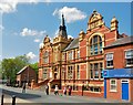
Chorley: The Education Support Centre
Image: © Mr Eugene Birchall
Taken: 18 May 2010
0.01 miles
2
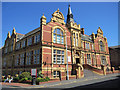
Chorley Library in Union Street
Chorley Library is dated 1905 on both pediments, either side of the front.
Image: © John S Turner
Taken: 28 Apr 2011
0.02 miles
3
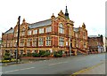
Chorley Public Library
This building was purpose built to be a school and was constructed to be "light and airy". It was originally called Chorley Technical & Secondary School, although most records simply list it as Chorley Grammar School.
It was opened by the 16th Earl of Derby [Frederick Arthur Stanley] on 24th September 1906. It was the Grammar School until 1962.
From 1962 - 1981 the building became Chorley Day Teacher Training College and was opened as such on 19th May 1962 by the then Minister of Education, Sir David Eccles. The college was the first to use closed circuit television in schools for the purpose of teacher training.
From 1986 to the present, the building became Chorley Library as the one on Avondale Road was rapidly running out of space.
Image: © Ann Cook
Taken: 29 Aug 2012
0.02 miles
4

Union Street, Chorley
Many years ago, the building on the right was a cinema. The red building [centre] stands on the site of the former bus station.
Image: © Ann Cook
Taken: 29 Aug 2012
0.02 miles
5
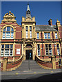
Steps to Chorley Library from Union Street
The grand frontage of Chorley Library, which was built in 1905.
Image: © John S Turner
Taken: 28 Apr 2011
0.02 miles
6

St Laurence's and the Grammar School plaque
Looking towards St Laurence's from Union Street. Just to the left of the metal pole there is a plaque set in the wall commemorating the rebuilding of the grammar school in 1824 - see Image The school disappeared from the O.S. maps between 1928 and 1938, so I presume the plaque is all that is left.
Image: © John S Turner
Taken: 28 Apr 2011
0.03 miles
7
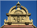
Pediment on Chorley Library
One of two pediments on either end of Chorley Library. This one is on the east end of the building.
Image: © John S Turner
Taken: 28 Apr 2011
0.03 miles
8

The Post Office, Cleveland Street
Chorley main post office is the building on the left.
Image: © Ann Cook
Taken: 29 Aug 2012
0.03 miles
9

Grammar School plaque in Union Street
This commemorative plaque is set into the low wall surrounding St Laurence's churchyard. Although it states that the grammar school was rebuilt in 1824, the school disappeared from the O.S. maps between 1928 and 1938. I have been unable to make out the wording below the date.
Image: © John S Turner
Taken: 28 Apr 2011
0.03 miles